| << Cookinseln - Tokelau-Inseln - Niue - Kermadecinseln |
||
|
||
Zuletzt angesehene Artikel:
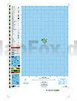
 | PI06 Nassau (Cookinseln) Topographische Landkarte 1:25.000 - Land Information New Zealand |
 | Erzgebirge - Erzgebirge Mitte (Blatt 115) - Hora Sv. Kateřiny - Jöhstadt - Klášterec n. Ohří - Kovářská - Měděnec - Olbernhau - Výsluní - Topographische Wanderkarte 1:25.000 EUROKART (tschechisch) Krušné hory - Erzgebirge, střed Geodezie On Line - Tschechien |
 | 3133SB LA CÔTE-ST-ANDRE - ST-JEAN-DE-BOURNAY Amtliche Topographische Wanderkarte Frankreich 1:25.000 - série bleue (IGN) |
 | PI12 Rarotonga (Cookinseln) Topographische Landkarte 1:25.000 - Land Information New Zealand |
 | Cederberg (wasserfest / GPS-kompatibel) topographische Straßenkarte 1:160.000 slingsby´s |
 | PI08 Suwarrow (Cookinseln) Topographische Landkarte 1:50.000 - Land Information New Zealand |
 | Europa 1:4.5 Mio. physikalisch (multilingual) Straßenkarte Kümmerly + Frey |