| << Cookinseln - Tokelau-Inseln - Niue - Kermadecinseln |
||
|
||
Zuletzt angesehene Artikel:
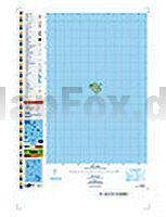
 | PI06 Nassau (Cookinseln) Topographische Landkarte 1:25.000 - Land Information New Zealand |
 | Marburg 3 Topographische Wanderkarte mit Wanderwegen 1:25.000 - ProjektNord |
 | Langtang 1:125.000 - Gosain Kund - Helambu - Naya Kanga - Panch Pokhari - Trekking Map - Nepal Map Publisher Pvt. Ltd. |
 | 40b Bingen - St. Goar - Oberes Mittelrheintal 1:25.000 Rad- und Wanderkarte mit Rettungspunkten Rundwanderwege mit Beschreibung auf der Rückseite GW Rheingau-Taunus-Kartographie |
 | Paiute ATV - Utah (Blatt: 708) Landkarte Trails Illustrated Map National Geographic - USA |
 | USA Southeast 1:1.3 Mio. (Blatt 3126) Landkarte Adventure Map USA National Geographic |