| << Cookinseln - Tokelau-Inseln - Niue - Kermadecinseln |
||
|
||
Zuletzt angesehene Artikel:
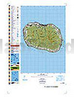
 | PI12 Rarotonga (Cookinseln) Topographische Landkarte 1:25.000 - Land Information New Zealand |
 | DUMONT Reise-Handbuch Finnland von Quack, Ulrich |
 | Rhön - Milseburg Topographische Wanderkarte mit Wanderwegen 1:25.000 - ProjektNord |
 | Martinique (aktuelle Jahresausgabe) Reiseführer (französisch) Guide du Routard |
 | Tokyo mit Yokohama CityTrip PLUS - Stadtführer Reise-Know-How Verlag |
 | Wyoming Recreation Map 1:750.000 Landkarte Benchmark Map USA |
 | Alpe-Adria-Trail - Vom Großglockner nach Triest - von Astrid Christ und Martin Marktl - Bergverlag Rother |
 | München Poster 70 x 100 cm - von Nina Simone Wilsmann - Vianina |
 | Abruzzen - von Sabine Becht, Sven Talaron - Michael-Müller-Verlag |
 | Toscana 1:200.000 Landkarte Reise-Know-How Verlag - world mapping project |
 | 16 MARCO POLO Freizeitkarte Rhein, Ruhr 1:110.000 wasserfest, reißfest |
 | Marokko / Morocco 1:1 Mio. Landkarte Reise-Know-How Verlag - world mapping project |
 | 14 Rügen 1:50.000 Outdoorkarte - Wanderkarte (wasserfest) Hiddensee - Stralsund - Kümmerly & Frey |
 | Vancouver - TOPO (Blatt VCBC1) Topographische Landkarte - Backroad Topo Map Kanada |
 | China 1:6 Mio. (CR712) *** SCHNÄPPCHEN *** Himalayan MapHouse - Nepal |
 | Bali 1:135.000 POSTER gefaltet Bali Wall Map Periplus Editors |
 | Irland 1:350.000 Landkarte Reise-Know-How Verlag - world mapping project |
 | Tedesco Kauderwelsch AusspracheTrainer auf CD Reise-Know-How Verlag |
 | Palermo Stadtplan 1:10.000 Palermo - Pianta della Citta L.A.C. GlobalMap Italien |
 | L`atlas Marocain, Nouvelles Routes touristiques Guide J. Gandini - Serre Editeur |