| << Cookinseln - Tokelau-Inseln - Niue - Kermadecinseln |
||
|
||
Zuletzt angesehene Artikel:
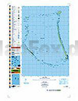
 | PI02 Nukunonu (Tokelau-Inseln) Topographische Landkarte 1:25.000 - Land Information New Zealand |
 | Ãsterreich 1:500.000 mit Distoguide StraÃenkarte Hallwag Verlag |
 | 174 Newbury & Wantage - Hungerford & Didcot - Wanderkarte GroÃbritannien 1:50.000 LANDRANGER MAP - Ordnance Survey |
 | 226 Ely & Newmarket - Wanderkarte GroÃbritannien 1:25.000 EXPLORER MAP - Active Map LAMINIERT - Ordnance Survey |
 | L-34-53-A Amtliche Topographische Karte Ungarn 1:50.000 |
 | 3531ETR SAINT-GERVAIS-LES-BAINS Topographische Wanderkarte Frankreich 1:25.000 (LAMINIERTE AUSGABE) TOP 25 IGN - (GPS) |
 | Riga und Umgebung Stadtplan-Atlas 1:10.000 / 1:100.000 - Jana Seta - Lettland Rīga un Apkartne |
 | 105F03 Crater Creek Topographische Landkarte 1:50.000 - Canada - Yukon |
 | Ãsterreich Panoramakarte 1:500.000 Magnetmarkiertafel freytag & berndt |
 | Verdens Ende Wanderkarte Norwegen 1:25.000 (Blatt 2479) - Nordeca / UGLAND / Statens Kartverk Norwegen |
 | Hausa - Wort für Wort Kauderwelsch-Sprachführer (Band 080) Nigeria, Niger - Reise-Know-How Verlag |
 | USA - Südwesten Reiseführer mit vielen praktischen Tipps - von Volker Feser - Michael-Müller-Verlag |
 | 328 Sanquhar & New Cumnock - Wanderkarte GroÃbritannien 1:25.000 EXPLORER MAP - Active Map LAMINIERT - Ordnance Survey |
 | Gebrauchsanweisung für Portugal - von Eckhart Nickel - Piper Verlag |
 | 3336ET LES DEUX ALPES/PARC DES ECRINS Topographische Wanderkarte Frankreich 1:25.000 TOP 25 IGN - (GPS) |
 | 438 Dornoch & Tain - Wanderkarte GroÃbritannien 1:25.000 EXPLORER MAP - Ordnance Survey |
| 2835-NO Topographische Karte 1:10.000 - Landesvermessungsamt Brandenburg |
 | Ceredigion Coast Top 10 Walks Series Circular Walks along the Wales Coast Path - Sioned Bannister- Northern Eye Books |
| 3648-SO Topographische Karte 1:10.000 - Landesvermessungsamt Brandenburg |
 | Karnischer Höhenweg Rother-Wanderführer Von Sillian nach Thörl-Maglern - 14 Etappen mit Varianten und Gipfeln - GPS - von Evamaria Wecker - Bergverlag Rother |