 One of a series of books in the new Top 10 Walks: Wales Coast Path series. Handy, pocket-sized, full colour walking guides written by experts. Each volume outlines the most popular circular walks along key sections of the coast path. Other titles in the series include: Llyn Peninsula, Cardigan Bay North and Carmarthen Bay & Gower.
These attractive and cleverly structured guidebooks give walkers the ten finest circular routes along a section of the Wales Coast Path in a popular pocketable format.
With clear information, an overview and introduction for each walk, expertly written numbered directions, enhanced Ordnance Survey maps, superb, eye-grabbing panoramic photographs, and interpretation of points of interest along the way, these guides set a new standard in reliability, clarity and ease-of-use.
Featured walks include: Ynyslas, Aberystwyth, Llanrhystud, Aberaeron, New Quay, Cwmtydu, Llangrannog, Aber porth & Tresaith, Mwnt, Cardigan.
Sioned Bannister is a professional outdoor writer and regular contributor to Welsh Coast Magazine. She is also a member of the Outdoor Writers and Photographers Guild.  Kartenausschnitt Kartenausschnitt
Kartenbeispiel
|
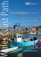
Ceredigion Coast Top 10 Walks Series Circular Walks along the Wales Coast Path - Sioned Bannister- Northern Eye Books
EAN / ISBN: 9781908632289
Preis: EUR 14.90
|
|


