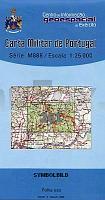
| << Portugal: Amtliche topografische Landkarten des Instituto Geográfico do Exército (IGeoE) 1:25.000 (Serie M888) |
||
|
||

Zuletzt angesehene Artikel:
 | 261 - Topographische Landkarte Portugal 1:25.000 Carta Militar de Portugal - Série M888 Instituto Geográfico do Exército (IGeoE) - Portugal |
 | 0223-2 REDONDELA Topographische Landkarte 1:25.000 Spanien (Grundlage MTN25) Instituto Geográfico Nacional - CNIG Spanien - ProjektNord |
 | Paddeln 3: Mecklenburgische Kleinseenplatte bis Feldberg (Bernhard Horn) - Grünes Herz |
 | 5309 (NM 33-12-09) Hohenau an der March Topographische Wanderkarte 1:50.000 mit Wegmarkierungen - Ãsterreich - Kartographie BEV - ProjektNord |
 | 372 - Topographische Landkarte Portugal 1:25.000 Carta Militar de Portugal - Série M888 Instituto Geográfico do Exército (IGeoE) - Portugal |
 | 2647 Fürstenwerder Sonderausgabe mit Wanderwegen - Topographische Wanderkarte Brandenburg 1:25.000 ProjektNord |
 | Allenstein Kreiskarte des Deutschen Reiches 1:100.000 (KDR 100 KK) - Faksimile Reichsamt für Landesaufnahme |
 | 4351 Drebkau Sonderausgabe mit Wanderwegen - Topographische Wanderkarte Brandenburg 1:25.000 ProjektNord |
 | 0809-4 VIÃUELA Topographische Landkarte 1:25.000 Spanien (Grundlage MTN25) Instituto Geográfico Nacional - CNIG Spanien - ProjektNord |
 | 3049 Chorin Sonderausgabe mit Wanderwegen - Topographische Wanderkarte Brandenburg 1:25.000 ProjektNord |
 | Segelführer GroÃe Masurische Seen Wielkie Jeziora Mazurskie - Przewodnik zeglarski Centrum Kartografii - Polen |
 | 3225 (NL 33-01-25) Sankt Peter in Ahrn Topographische Wanderkarte 1:50.000 mit Wegmarkierungen - Ãsterreich - Kartographie BEV - ProjektNord |
 | Cornwall Guidebook (engl.) Goldeneye Publications - GroÃbritannien |
 | Roztocze Mitte 1:50.000 Touristische Landkarte - Polen Roztocze Środkowe mapa Compass - Polen |
 | Scotland map Planungskarte (engl.) Lonely Planet |
 | Mit dem Wohnmobil nach Finnland (Band 41) Womo-Verlag |
 | L-34-15-D Monor Amtliche Topographische Karte Ungarn 1:50.000 |
 | 413 - Topographische Landkarte Portugal 1:25.000 Carta Militar de Portugal - Série M888 Instituto Geográfico do Exército (IGeoE) - Portugal |
 | 0340-1 MANGANESES DE LA LAMPREANA Topographische Landkarte 1:25.000 Spanien (Grundlage MTN25) Instituto Geográfico Nacional - CNIG Spanien - ProjektNord |
 | 4204 (NL 33-02-04) Gaming Topographische Wanderkarte 1:50.000 mit Wegmarkierungen - Ãsterreich - Kartographie BEV - ProjektNord |