
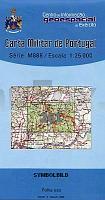
| << Portugal: Amtliche topografische Landkarten des Instituto Geográfico do Exército (IGeoE) 1:25.000 (Serie M888) |
||
|
||


Zuletzt angesehene Artikel:
 | 261 - Topographische Landkarte Portugal 1:25.000 Carta Militar de Portugal - Série M888 Instituto Geográfico do Exército (IGeoE) - Portugal |
 | 794-2 CANALS Amtliche topographische Landkarte 1:25.000 Spanien (M.T.N.) 794-2 Mapa Topográfico Nacional de Espana (MTN25) Instituto Geográfico Nacional - CNIG Spanien |
 | Kleiner Autoatlas Moskau (A5) 1:36.500, 1:19.000 mit Verkehrszeichen Awto Atlas Moskwi s doroschnimi znakami AGT Geocenter Russland |
 | 457-3 CANTIMPALOS Amtliche topographische Landkarte 1:25.000 Spanien (M.T.N.) 457-3 Mapa Topográfico Nacional de Espana (MTN25) Instituto Geográfico Nacional - CNIG Spanien |
 | Woiwodschaft Schlesien - Straßenkarte moto TIR 1:250.000 Śląskie mapa województwa Demart - Polen |
 | Kyyvesi vesistömatkailukartta 1:100.000 Touristische Wasserwegekarte Karttakeskus - Finnland |
 | 1013-3 VELEFIQUE Topographische Landkarte 1:25.000 Spanien (Grundlage MTN25) Instituto Geográfico Nacional - CNIG Spanien - ProjektNord |
 | Niedere Beskiden (Ostteil) Topographische Wanderkarte Polen 1:50.000 Beskid Niski - czesc wschodnia (GPS) - WZKART Polen |
 | T4233 Iso-Vietonen Topographische Karte 1:25.000 EUREF (Peruskartta) Maanmittauslaitos / Lantmäteriverket Finnland - ProjektNord |
 | N3342 Karvia Topographische Karte 1:25.000 EUREF (Peruskartta) Maanmittauslaitos / Lantmäteriverket Finnland - ProjektNord |
 | 0170 HARO Topographische Landkarte 1:50.000 Spanien (Grundlage MTN50) Instituto Geográfico Nacional - CNIG Spanien - ProjektNord |
 | 337-2 ALTO DE LAS MAYADAS Amtliche topographische Landkarte 1:25.000 Spanien (M.T.N.) 337-2 Mapa Topográfico Nacional de Espana (MTN25) Instituto Geográfico Nacional - CNIG Spanien |
 | 2413-II-SØ Topographische Karte Dänemark 1:25.000 Topografisk kort Danmark (DTK/Kort25) 2413-II-SØ ProjektNord - Kort & Matrikelstyrelsen / Geodætisk Institut |
 | 0755-4 TALARRUBIAS Topographische Landkarte 1:25.000 Spanien (Grundlage MTN25) Instituto Geográfico Nacional - CNIG Spanien - ProjektNord |
 | 1003 Utrera Amtliche topographische Landkarte 1:50.000 Spanien (M.T.N.) 1003 Mapa Topográfico Nacional de Espana (MTN50) Instituto Geográfico Nacional - CNIG Spanien |
 | 0598-1 OLIVA DE PLASENCIA Topographische Landkarte 1:25.000 Spanien (Grundlage MTN25) Instituto Geográfico Nacional - CNIG Spanien - ProjektNord |
 | 0570-3 BENASSAL Topographische Landkarte 1:25.000 Spanien (Grundlage MTN25) Instituto Geográfico Nacional - CNIG Spanien - ProjektNord |
 | 0726 EL PINO Topographische Landkarte 1:50.000 Spanien (Grundlage MTN50) Instituto Geográfico Nacional - CNIG Spanien - ProjektNord |
 | 0716 SAN CLEMENTE Topographische Landkarte 1:50.000 Spanien (Grundlage MTN50) Instituto Geográfico Nacional - CNIG Spanien - ProjektNord |
 | 01-44 Klasterec nad Ohri Topographische Karte 1:50.000 der Tschechischen Republik Zakladní mapa Ceská republika - Cesky urad zememericky a katastralni - ProjektNord |