| << Tasmap << Tasmanien |
  | |
|
||
Zuletzt angesehene Artikel:
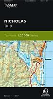
![]() | TK10 Nicholas 1:50.000 Topographische Landkarte Tasmanien - Australien - Tasmap (Tasmanien) |
![]() | Motorrad-Tourenführer Piemont - Aostatal - von Hans-Jochen Kraft - Hallwag |
![]() | M-34-68-C/D Ropczyce Amtliche topographische Landkarte Polen 1:50.000 M-34-68-C/D Ropczyce - Mapa Topograficzna Polski Glowny Geodeta Kraju |
![]() | Mannheim - Weinheim Topographische Wanderkarte Baden-Württemberg / Rheinland-Pfalz mit Wanderwegen und Radwegen 1:25.000 - ProjektNord |
![]() | Budapest Fahrradkarte 1:30.000 Budapest kerékpáros térkép / Budapest bicycle map - Frigoria Ungarn |
![]() | Herne 1975 (Blatt 98) Historischer Bildstadtplan Bollmann-Bildkarten-Verlag |
![]() | 4603 GT Pointe-Ã -Pitre - Ste-Anne - Guadeloupe 1:25.000 Topographische Wanderkarte IGN (TOP25) Pointe-Ã -Pitre, Ste-Anne, Guadeloupe |
![]() | Skjerstadfjorden - Rognan - Seekarte Norwegische Küste 1:50.000 - (Blatt 137) Den Norske Kyst Sjøkart - Hovedkart (sjø) Statens Kartverk Sjø - Norwegen |
![]() | 1821 Albersdorf Topographische Landkarte 1:25.000 Landesvermessungsamt Schleswig-Holstein |
![]() | Belgien Süd - Ardennen 1:200.000 Straßenkarte (Blatt 534) Michelin Regional |
![]() | M-34-49-C/D Kedzierzyn-Kozle Amtliche topographische Landkarte Polen 1:50.000 M-34-49-C/D Kedzierzyn-Kozle - Mapa Topograficzna Polski Glowny Geodeta Kraju |
![]() | A Guide to trails in the Western Aosta Valley by Luca Zavatta - Wanderführer - l`Escursionista Editore - Italien |
![]() | M-33-60-C/D Krapkowice Amtliche topographische Landkarte Polen 1:50.000 M-33-60-C/D Krapkowice - Mapa Topograficzna Polski Glowny Geodeta Kraju |
![]() | 1093 HORNLI 1:25.000 - Bauma - Fischingen - Lichtensteig - Topographische Landeskarte der Schweiz - swisstopo |
![]() | 31 Valpelline - Saint Barthélemy - Aosta-Valle Centrale 1:25.000 Topographische Wanderkarte und Straßenkarte 1:25.000 Fraternali Editore - Italien |
![]() | Ure - Gimsøystraumen - Svolvær - Seekarte Norwegische Küste 1:50.000 - (Blatt 74) Den Norske Kyst Sjøkart - Hovedkart (sjø) Statens Kartverk Sjø - Norwegen |
![]() | 75 KILKENNY / WATERFORD Wanderkarte Irland 1:50.000 DISCOVERY MAP - Ordnance Survey |
![]() | M-34-48-C/D Hrubieszow Amtliche topographische Landkarte Polen 1:50.000 M-34-48-C/D Hrubieszow - Mapa Topograficzna Polski Glowny Geodeta Kraju |
![]() | Ustron - Goleszow und Umgebung Schlesische Beskiden Touristenkarte 1:25.000 USTROŃ GOLESZÓW i okolice Beskid Ślaski PLAN Galileos - Polen |
![]() | Sextener Dolomiten - Alpenvereinsführer extrem - Bergverlag Rother |


