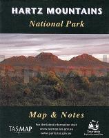
| << Tasmap << Tasmanien |
  | |
Zuletzt angesehene Artikel:
![]() | Hartz Mountains National Park 1:50.000 Topographische Wanderkarte Tasmanien - Australien - Tasmap (Tasmanien) |
![]() | Libanon 1:190.000 mit Stadtplan Beirut 1:8.300 Landkarte - ITMB International Travel Maps (engl.) Lebanon and Beirut |
![]() | Lykien Landkarte 1:250.000 (türkische Ausgabe) Likya Gezi planı - detaylı Likya haritası Aydal - Türkei |
![]() | Lüneburg 1972 (Blatt 122) Historischer Bildstadtplan Bollmann-Bildkarten-Verlag |
![]() | VIA CZECHIA Südlicher Trail - Kartenset 3 - Gratzener Bergland - Böhmerwald - Etappen J17-J24 Topographische Wanderkarte 1:25.000 EUROKART (tschechisch) VIA CZECHIA - Jižnà stezka, BOX 3, Krajinou Novohradských hor a Šumavy Geodezie On Line - Tschechien |
![]() | 2928SB CLUNY - MATOUR GPS Amtliche Topographische Wanderkarte Frankreich 1:25.000 - série bleue (IGN) |
![]() | 1326SB la Roche-sur-Yon - Bournezeau - GPS Amtliche Topographische Wanderkarte Frankreich 1:25.000 - série bleue (IGN) |
![]() | 1729SB Civray - Sauzé-Vaussais GPS Amtliche Topographische Wanderkarte Frankreich 1:25.000 - série bleue (IGN) |
![]() | 4250OT CORTE / MONTE CINTO - PNR de Corse - Topographische Wanderkarte Frankreich 1:25.000 TOP 25 IGN |
![]() | 2234SB La Roche-Canillac - Marcillac-la-Croisille GPS Amtliche Topographische Wanderkarte Frankreich 1:25.000 - série bleue (IGN) |
![]() | 3336ET LES DEUX ALPES/PARC DES ECRINS Topographische Wanderkarte Frankreich 1:25.000 TOP 25 IGN - (GPS) |
![]() | 1647ET LOURDES/ARGELES GAZOST/LE LAVEDAN Topographische Wanderkarte Frankreich 1:25.000 TOP 25 IGN - (GPS) |
![]() | Argentinien 1:2.2 Mio. Landkarte - ITMB International Travel Maps (engl.) Argentina |
![]() | 2786 07 Lukla - Salleri (21) 1:50.000 Dudh Kosi FINN MAPS - HMG Nepal |
![]() | Nord Straßenkarte 1:150.000 Frankreich (Blatt 302) Michelin Départements |
![]() | 1052 ANDELFINGEN 1:25.000 - Marthalen - Hettlingen - Gaschnang - Topographische Landeskarte der Schweiz - swisstopo |
![]() | 3013SB Ste-Menehould - Valmy GPS Amtliche Topographische Wanderkarte Frankreich 1:25.000 - série bleue (IGN) |
![]() | Venezien 1:200.000 Straßenkarte Italien (Blatt 355) Veneto Michelin Local |
![]() | 2039SB Cahors (Ouest) - Labastide-Marnhac - Montcuq GPS Amtliche Topographische Wanderkarte Frankreich 1:25.000 - série bleue (IGN) |
![]() | CK412: Vestmarka / Kjekstadmarka - sommer Fjellkart / Turkart 1:30.000 Cappelens Kart - / Wanderkarte Sommerausgabe - Norwegen |


