 Doppelseitig bedruckte topographische Wanderkarte, die auf dem sythetischen Papier Polyart gedruckt ist.
wasserfest und reiĂfest.  Kartenbeispiel aus der Serie Kartenbeispiel aus der Serie
Blattßbersicht 1:50.000 Sentiero Italia und Einzelblätter Blattßbersicht 1:25.000 und detaillierter Westalpen Mittlere Alpen: Sßdtirol, Dolomiten Toskana Mittelitalien Sardinien Kartenausschnitt
|
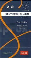
Blatt 3A: Reggio Calabria - Caporosa 1:50.000 - Wanderkarte - Sentiero Italia CAI - Calabria - 4land / Idea Montagna
Carta itineraria del Sentiero Italia del primo tratto in Calabria, da Reggio Calabria a Caporosa 4land / Idea Montagna
EAN / ISBN: 9791280496904
Preis: EUR 16.90
|
| 

