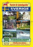
| << Schweden: Regionalkarten und Regional-Atlanten << Schweden: Wanderführer, Radführer und Reiseführer (schwedischsprachig) << Svenska Cykelsällskapet SCS - Schwedischer Radfahrerverband |
  | |
Zuletzt angesehene Artikel:
![]() | Schweden Touristen- und Fahrradführer Teil 2A+2B (Mittlerer Teil) - Sverigeleden mit Sehenswürdigkeiten und ausführlichen Karten 1:250.000 Turist & Cykelguide SVERIGE - med sevärdheter och utförliga kartor - SVERIGELEDEN - fräscha upplevelser från norr till söder - (Del 2A+2B) Mellersta delen - Ångermanland - Härjedalen - Värmland - Mälardalen Svenska Cykelsällskapet - Schweden |
![]() | 127 Orleans - Blois Topographische Touristische Landkarte Tourismus und Fahrrad (wasserfest) - tourisme et vélo plastifiée TOP100 - 1:100.000 - IGN Frankreich |
![]() | Westpreußen östlich der Weichsel - 1:100.000 - Ortsnamenkarte von Dirk Bloch - BLOCHPLAN |
![]() | MORBIHAN (Blatt D56) Département-Landkarte Frankreich 1:100.000 MORBIHAN - Carte départementale - IGN Frankreich |
![]() | 918 Frankreich zu Pferde 1:1 Mio. Landkarte FRANCE TOURISME EQUESTRE IGN - Frankreich |
![]() | 28 BODENSEE 1:100.000 Topographische Landeskarte der Schweiz - swisstopo |
![]() | 216 FRAUENFELD 1:50.000 - Andelfingen - Winterthur - Wil - Topographische Landeskarte der Schweiz - swisstopo |
![]() | Untere Oder 2 Topographische Wanderkarte mit Wanderwegen und Radwegen 1:50.000 - ProjektNord |
![]() | 2018SB Châteaudun - Brou GPS Amtliche Topographische Wanderkarte Frankreich 1:25.000 - série bleue (IGN) |
![]() | TP07 Meadowbank 1:50.000 Topographische Landkarte Tasmanien - Australien - Tasmap (Tasmanien) |
![]() | Brasilien 1:4 Mio. Landkarte Brésil IGN |
![]() | Cabo Froward 1:100.000 Trekkingkarte Cabo Froward Trekking Map Viachile Editores - Chile |
![]() | Gauteng (Central) Straßenatlas 1:20.000 (Spiralo) Gauteng central street guide MapStudio Südafrika |
![]() | 1925SB Preuilly-sur-Claise / le Grand-Pressigny GPS Amtliche Topographische Wanderkarte Frankreich 1:25.000 - série bleue (IGN) |
![]() | VAUCLUSE (Blatt D84) Département-Landkarte Frankreich 1:100.000 VAUCLUSE - Carte départementale - IGN Frankreich |
![]() | Visitor´s Guide to Garden Route & Route 62 1:28.600 MapStudio Südafrika |
![]() | PAYS DU MONT-CENIS - Haute Maurienne - Vanoise - Valle di Susa 1:50.000 Wanderkarte Culture & environnement / Kultur und Natur - IGN Frankreich |
![]() | 3841OT VALLEE DE LA ROYA - Vallée des Merveilles - Parc Nacional du Mercantour Topographische Wanderkarte Frankreich 1:25.000 TOP 25 IGN - (GPS) |
![]() | INDRE - CHÂTEAUROUX - ISSOUDUN - LE BLANC - PNR DE LA BRENNE (Blatt D36) Département-Landkarte Frankreich 1:100.000 INDRE - Carte départementale - IGN Frankreich |
![]() | PI02 Nukunonu (Tokelau-Inseln) Topographische Landkarte 1:25.000 - Land Information New Zealand |


