| << Russland: Städte, Stadtpläne, Stadtatlanten, Stadtführer << Russland: Oblaste und Regionen etc. << Rus Co. Ltd. |
||
|
||
Zuletzt angesehene Artikel:
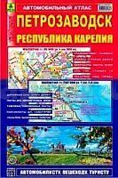
 | Petrosawodsk - Republik Karelien Stadtatlas und StraÃenatlas 1:20.000 / 1:750.000 Petrozavodsk / Respublika Karelija Rus Co. Ltd. - Russland |
 | Masuren - Krutynia und Spirdingsee Touristenkarte 1:60.000 (wasserfest) GPS MAZURY - szlak Krutyni Jezioro Sniardwy (mapa wodoodporna) Compass - Polen |
 | GreenVelo: Kleinpolen - Krakau (Westteil) 1:100.000 Radwanderkarte der Radwege - Steinpapier Małopolska, Kraków i okolice, część zachodnia GreenVelo mapa tras rowerowych (papier skalny) Europilot - Daunpol - Polen |
 | 0717-4 QUINTANAR DEL REY Topographische Landkarte 1:25.000 Spanien (Grundlage MTN25) Instituto Geográfico Nacional - CNIG Spanien - ProjektNord |
 | 251-1 LA PUEBLA DE RODA Amtliche topographische Landkarte 1:25.000 Spanien (M.T.N.) 251-1 Mapa Topográfico Nacional de Espana (MTN25) Instituto Geográfico Nacional - CNIG Spanien |
 | Stockholm 1:30.000 Schlittschuhkarte Schweden - Calazo Förlag Schweden Skridskokarta Stockholm Calazo Förlag Schweden |
 | 3913 01 Ailigas Topographische Karte 1:20.000 (Maastokartta / Peruskartta / Grundkarta) Maanmittauslaitos / Lantmäteriverket Finnland - ProjektNord |
 | 9 Region Bern 1:60.000 mit Ortsindex - Wanderkarte (wasserfest) *** SCHNÃPPCHEN *** Schweiz - Kümmerly & Frey |
 | 4868 Breslau (Nord) Topographische Karte 1:25.000 Messtischblatt des Deutschen Reiches - PreuÃische Landesaufnahme / Reichsamt für Landesaufnahme - Faksimile ProjektNord |
 | 0722 VALÃNCIA Topographische Landkarte 1:50.000 Spanien (Grundlage MTN50) Instituto Geográfico Nacional - CNIG Spanien - ProjektNord |
 | 0878-3 VALVERDE DE LLERENA Topographische Landkarte 1:25.000 Spanien (Grundlage MTN25) Instituto Geográfico Nacional - CNIG Spanien - ProjektNord |
| Erläuterungen zur Geologischen Karte 5540 Falkenstein (144) - Ausgabe 1909 Sächsisches Landesamt für Umwelt, Landwirtschaft und Geologie |
 | 1021 02 Finbo Topographische Karte 1:20.000 (Maastokartta / Peruskartta / Grundkarta) Maanmittauslaitos / Lantmäteriverket Finnland - ProjektNord |
 | 2834 03 Skiettsamtuodd Topographische Karte 1:20.000 (Maastokartta / Peruskartta / Grundkarta) Maanmittauslaitos / Lantmäteriverket Finnland - ProjektNord |
 | 6330 Uehlfeld Topographische Landkarte Bayern 1:25.000 - Normalausgabe - ProjektNord (geplottete Ausgabe) - Grundlage amtliche Topographische Karte Bayern DTK25 |
 | 3231 02 Kyyvesi Topographische Karte 1:20.000 (Maastokartta / Peruskartta / Grundkarta) Maanmittauslaitos / Lantmäteriverket Finnland - ProjektNord |
| 1565 Grupenhagen Topographische Karte 1:25.000 Messtischblatt des Deutschen Reiches - PreuÃische Landesaufnahme / Reichsamt für Landesaufnahme - Faksimile ProjektNord |
 | 2311 10 Liuhtari Topographische Karte 1:20.000 (Maastokartta / Peruskartta / Grundkarta) Maanmittauslaitos / Lantmäteriverket Finnland - ProjektNord |
 | 4322 07 Lamparevaara Topographische Karte 1:20.000 (Maastokartta / Peruskartta / Grundkarta) Maanmittauslaitos / Lantmäteriverket Finnland - ProjektNord |
 | 2511-I Damsholte - mit Wanderwegen und Fahrradrouten Topographische Fahrradkarte und Wanderkarte Dänemark 1:50.000 - Kort & Matrikelstyrelsen ProjektNord 2511-I Damsholte - Topografisk Cykel- og Vandrekort Danmark |