| << Deutschland: Topographische Karten 1:50.000 im Regelblattschnitt nach Blattnummern (0-4499) << Niedersachsen und Bremen: Topographische Landkarten 1:50.000 vom Landesvermessungsamt Niedersachsen |
  | |
Zuletzt angesehene Artikel:
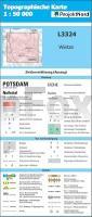
![]() | L3324 Wietze (geplottete Ausgabe) Topographische Karte 1:50.000 Kartografie Landesvermessungsamt Niedersachsen - ProjektNord |
![]() | Yorkshire Dales Fahrradkarte 1:126.720 Cycling maps - country lanes & byways (waterproof) Yorkshire Dales cycling map Goldeneye Publications - Großbritannien |
![]() | Fertö - Touristenkarte Tertö turistaterkép Paulus - Ungarn |
![]() | W5144 Topographische Karte 1:25.000 EUREF (Peruskartta) Maanmittauslaitos / Lantmäteriverket Finnland - ProjektNord |
![]() | 147 - Topographische Landkarte Portugal 1:25.000 Carta Militar de Portugal - Série M888 Instituto Geográfico do Exército (IGeoE) - Portugal |
![]() | Mallorca Sunflower-Wanderführer - englisch - kostenlose Updates - car tours & walks |
![]() | Lissabon CityTrip PLUS - Stadtführer Reise-Know-How Verlag |
![]() | Orlovskaja Oblast 1:200.000 Autoatlas / Straßenatlas - Russland Орловская область. Самый подробный атлас автодорог Astrel - Russland |
![]() | Neuseeland Wohnmobil & Camping-Atlas (spiral) New Zealand Motorhome & Camping atlas spiral HEMA maps Australien |
![]() | 10-3 RIBADEO Amtliche topographische Landkarte 1:25.000 Spanien (M.T.N.) 10-3 Mapa Topográfico Nacional de Espana (MTN25) Instituto Geográfico Nacional - CNIG Spanien |
![]() | 6542 Untergrafenried Topographische Landkarte Bayern 1:25.000 - Normalausgabe - ProjektNord (geplottete Ausgabe) - Grundlage amtliche Topographische Karte Bayern DTK25 |
![]() | 5920 Alzenau Topographische Landkarte Bayern 1:25.000 - Normalausgabe - ProjektNord (geplottete Ausgabe) - Grundlage amtliche Topographische Karte Bayern DTK25 |
![]() | 183 Val Badia / Gadertal 1:25.000 Wander- und Mountainbikekarte - 4land |
![]() | 313 Corvoeiro (Macao) Topographische Landkarte Portugal 1:25.000 Carta Militar de Portugal - Série M888 Instituto Geográfico do Exército (IGeoE) - Portugal |
![]() | L-34-15-B Gödöllö Amtliche Topographische Karte Ungarn 1:50.000 |
![]() | Trans-Siberian Handbook Reiseführer englisch Trailblazer |
![]() | Q16 Ruhpolding - Inzell - Schneizlreuth - Bad Reichenhall-West - Sonntagshorn *** SCHNÄPPCHEN *** ATK25 Topographische Karte 1:25.000 (Atkis) Bayern Landesvermessungsamt Bayern - Wanderkarte - Radwanderkarte |
![]() | 8228 Wildpoldsried Topographische Landkarte Bayern 1:25.000 - Normalausgabe - ProjektNord (geplottete Ausgabe) - Grundlage amtliche Topographische Karte Bayern DTK25 |
![]() | England 1592 Historische Landkarte auf Pergament (Faksimile) - 50 x 37,5 cm - PLANO gerollt Antica Angleterre Antica |
![]() | S4321 Kuivaniemi Topographische Karte 1:25.000 EUREF (Peruskartta) Maanmittauslaitos / Lantmäteriverket Finnland - ProjektNord |


