| << Cookinseln - Tokelau-Inseln - Niue - Kermadecinseln |
||
|
||
Zuletzt angesehene Artikel:
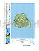
 | PI17 Mangaia (Cookinseln) Topographische Landkarte 1:25.000 - Land Information New Zealand |
 | Nürnberg und Umgebung ADFC-Regionalkarte 1:75.000 BVA Bielefelder Verlag |
 | Liegnitz plus 3 Stadtplan 1:15.000 (Bunzlau - Glogau - Lüben) Legnica plus 3 (Boleslawiec - Glogow - Lubin) - DEMART - Polen |
 | 1322 Tarp Topographische Landkarte 1:25.000 Landesvermessungsamt Schleswig-Holstein |
 | Akamas Region - Hiking map Cyprus Latchi - Neo Chorio - Prodromi - Polis - Avakas-Schlucht Wanderkarte 1:25.000 - Kartographos |
 | 5910 Kastellaun Topographische Karte 1:25.000 - Landesamt für Vermessung und Geobasisinformation Rheinland-Pfalz |
 | Brasilianisch kulinarisch - Wort für Wort Kauderwelsch-Sprachführer (Band 184) Brasilien - Reise-Know-How Verlag |
 | 6616 Speyer Topographische Karte 1:25.000 - Landesamt für Vermessung und Geobasisinformation Rheinland-Pfalz |
 | 14 Myrdalsjökull Atlaskort - Topographische Landkarte Island 1:100.000 Mýrdalsjökull Forlagid - Mál og menning - Island |
 | 5610 Bassenheim Topographische Karte 1:25.000 - Landesamt für Vermessung und Geobasisinformation Rheinland-Pfalz |
 | L-34-6-A-b Amtliche Topographische Karte Ungarn 1:25.000 |
 | New York State Road Map - Easy to Read! - Landkarte / Straßenkarte USA Rand McNally |
 | 105M07 Highland Lake - Yukon Territory Topographische Landkarte 1:50.000 - Canada - Yukon |
 | Tukums (Tuckum) Kreiskarte Lettland 1:75.000 mit Stadtplänen Tukuma Rajons - Jana Seta Lettland |
 | Loire-Tal 1:200.000 Straßenkarte Frankreich - (Blatt 517) Pays de la Loire Michelin Regional |
 | B12 Torellbreen Spitzbergen / Svalbard / Spitsbergen - Topographische Karte 1:100.000 Norsk Polarinstitutt |
 | Kapverden The premier guidebook for Business Globetrotters (englisch) Cape Verde eBiz Guides |
 | 097 Kendal & Morecambe - Windermere & Lancaster - Wanderkarte Großbritannien 1:50.000 LANDRANGER MAP - Ordnance Survey |
 | Radtourenbuch Taipeh und Umgebung ready to go: Tourguide, Karten und GPS-Tracks - von Kaden, Detlef - IS.RADWEG |
 | 3430ETR LA CLUSAZ/LE GRAND-BORNAND Topographische Wanderkarte Frankreich 1:25.000 (LAMINIERTE AUSGABE) TOP 25 IGN - (GPS) |