| << Cookinseln - Tokelau-Inseln - Niue - Kermadecinseln |
||
|
||
Zuletzt angesehene Artikel:
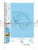
 | PI16 Penrhyn (Cookinseln) Topographische Landkarte 1:50.000 - Land Information New Zealand |
 | 4330 Benneckenstein (Harz) Topographische Karte 1:25.000 Landesamt für Vermessung und Geoinformation Sachsen-Anhalt (Landesvermessungsamt) |
 | Provinz Taschkent / Toshkent Landkarte 1:500.000 Toškent viloyati - Usbekistan |
 | Velebit 4 mit Wanderwegen und Radwegen - Wanderkarte - Fahrradkarte 1:35.000 Kroatien - ProjektNord |
| 2033SB Saint-Yrieix-le-Perche - Lubersac GPS Amtliche Topographische Wanderkarte Frankreich 1:25.000 - série bleue (IGN) |
 | Cygnet 1:25.000 Topographische Landkarte Tasmanien - Australien - Tasmap (Tasmanien) |
 | 0618OT Châteauneuf-du-Faou - Vallée l`Aulne - PNR Armorique Topographische Wanderkarte Frankreich 1:25.000 TOP 25 IGN - (GPS) |
| 2415OT EVRY - MELUN Topographische Wanderkarte Frankreich 1:25.000 TOP 25 IGN - (GPS) |
| 2885 11 Langtang Lirung (31) 1:50.000 Langtang Glacier and Langtang Himal FINN MAPS - HMG Nepal |
 | LOIRET *** SCHNÄPPCHEN *** (Blatt D45) Département-Landkarte Frankreich 1:100.000 LOIRET - Carte départementale - Découvertes régionales - IGN Frankreich |
 | 4253OT PETRETO-BICCHISANO/ZICAVO Topographische Wanderkarte Frankreich 1:25.000 TOP 25 IGN |
 | Rund um den Georgsberg (Blatt 100) Topographische Wanderkarte 1:25.000 EUROKART (tschechisch) Podřipsko Geodezie On Line - Tschechien |
 | PI05 Pukapuka (Cookinseln) Topographische Landkarte 1:25.000 - Land Information New Zealand |
 | 39 FLUELAPASS 1:100.000 - Arosa - Davos - Zernez - Scuol - Topographische Landeskarte der Schweiz - swisstopo |
 | 2129 Lübeck West Topographische Landkarte 1:25.000 Landesvermessungsamt Schleswig-Holstein |
| 4233 Ballenstedt Topographische Karte 1:25.000 Landesamt für Vermessung und Geoinformation Sachsen-Anhalt (Landesvermessungsamt) |
| 2785 07A Banepa (47) 1:25.000 Kathmandu Valley Trek FINN MAPS - HMG Nepal |
 | Slowenien - Kroatien - Bosnien-Herzigowina - Serbien - Montenegro - Mazedonien Nord 1:1 Mio. Straßenkarte (Blatt 736) Michelin |
 | Wolfenbüttel 1994 (Blatt 271) Historischer Bildstadtplan Bollmann-Bildkarten-Verlag |
 | Frische Nehrung - Polen Topographische Wanderkarte und Touristische Landkarte 1:15.000 Mierzeja Wiślana ProjektNord |