| << Cookinseln - Tokelau-Inseln - Niue - Kermadecinseln |
||
|
||
Zuletzt angesehene Artikel:
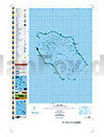
 | PI16 Penrhyn (Cookinseln) Topographische Landkarte 1:50.000 - Land Information New Zealand |
 | Sri Lanka 1:525.000 StraÃenkarte Sri Lanka Travel Map Periplus Editors |
 | 045 Stonehaven & Banchory - Wanderkarte GroÃbritannien 1:50.000 LANDRANGER MAP - Ordnance Survey |
 | 71 Pisek Wanderkarte Tschechien 1:50.000 - KCT - Papierausgabe 71 Pisecko |
 | 246.33 Nowa Wola Amtliche topographische Karte 1:25.000 Polen |
 | 16 Gesenke - Touristische Landkarte Tschechien 1:100.000 JesenÃky - Turistická mapa KARTOGRAFIE PRAHA |
 | Midi Toulouseain Pyrénnées - Gers - LeGuideVert - Grüner Reiseführer (französisch) - Michelin |
 | Tibetisch - Wort für Wort Kauderwelsch-Sprachführer (Band 033) Tibet - Reise-Know-How Verlag |
| 354.4 Labiszyn Amtliche topographische Karte 1:50.000 Polen |
 | Hanau - Offenbach - Seligenstadt Topographische Wanderkarte mit Wanderwegen 1:25.000 - ProjektNord |
 | 163 Gravesend & Rochester - Wanderkarte GroÃbritannien 1:25.000 EXPLORER MAP - Active Map LAMINIERT - Ordnance Survey |
 | Marburg 3 Topographische Wanderkarte mit Wanderwegen 1:25.000 - ProjektNord |
| 205.31 Amtliche topographische Karte 1:25.000 Polen |
 | Usbekisch - Wort für Wort Kauderwelsch-Sprachführer (Band 129) Reise-Know-How Verlag |
 | Kletterführer Berner Jura - Biel - Moutier (franz./dt.) Schweizer Alpen-Club |
 | Zittauer Gebirge - Westlicher Teil Wanderkarte 1:10.000 - Rolf Böhm Verlag |
 | Nikolsdorfer Wände Wanderkarte 1:10.000 - Rolf Böhm Verlag |
 | Usedom - mit Wollin und Stettiner Haff - 46 Touren. Mit GPS-Daten - Rother Wanderführer von Manfred Schmid-Myszka - Bergverlag Rother |
| 341.2 Maszewo Amtliche topographische Karte 1:50.000 Polen |
 | 4252OTR MONTE RENOSO / BASTELICA - PNR de Corse - Topographische Wanderkarte Frankreich 1:25.000 (LAMINIERTE AUSGABE) TOP 25 IGN - (GPS) |