| << Cookinseln - Tokelau-Inseln - Niue - Kermadecinseln |
||
|
||
Zuletzt angesehene Artikel:
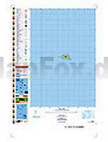
 | PI14 Takutea (Cookinseln) Topographische Landkarte 1:25.000 - Land Information New Zealand |
 | Loch Lomond and Trossachs National Park Vol 2 - East Mica Walkers` Guide - 60 walks |
 | DUMONT Reise-Taschenbuch Belgien von Tiburzy, Reinhard |
 | Burgund Regionale Straßenkarte 1:200.000 (Blatt 519) Michelin Frankreich |
 | Costa Rica und Panama Reiseatlas 1:300.000 Reiseatlas ITMB International Travel Maps (engl.) |
 | Elberadweg in der Region Hradec Králové 1:45.000 - 1:60.000 (deutschsprachig) - Fahrradatlas - von Jan Ritter - Labská stezka - Tschechien |
 | 20/7-8 STADEN - ROESELARE NGI 1:25.000 Topographische Landkarte Belgien |
 | Herzstoß Roman. Psychothriller. Übersetzung: Lutze, Kristian - von Joy Fielding - Goldmann |
 | 15 short walks Orkney Islands Wanderführer Schottland - Cicerone Großbritannien (englisch) |
 | 206 Edge Hill & Fenny Compton - Wanderkarte Großbritannien 1:25.000 EXPLORER MAP - Ordnance Survey |
 | Indien 1:2.4 Mio. (wasserfest) Landkarte - ITMB International Travel Maps (engl.) India |
 | 125 Prager Umgebung - Slapy-Stausee Fahrradkarte Tschechien 1:60.000 Okolí Prahy - Slapy - SHOCart |
 | 146 Lampeter & Llandovery - Wanderkarte Großbritannien 1:50.000 LANDRANGER MAP - Ordnance Survey |
 | Coast to Coast Walk 1:25.000 Wanderatlas Adventure Series - Geographers` A-Z Großbritannien |
 | Cho Oyu (Himalaya) 1:50.000 Trekkingkarte (CL808) Himalayan MapHouse - Himalayan Maphouse Cho Oyu - The Turquoise Goddess - Climbing Map |
 | Oberlausitz Laminierte Freizeitkarte 1:120.000 Sachsen Kartographie (Blatt 107) |
 | Dovrefjell Snøhetta Wanderkarte Norwegen 1:50.000 (Blatt 2829) - Nordeca / UGLAND / Statens Kartverk Norwegen |
 | 16 Pürglitz - Rakonitz - Karlstein Wanderkarte Tschechien 1:50.000 Krivoklatsko - Rakovnicko - Karlstejn - SHOCart |
 | 306 Kythira 1:50.000 Landkarte Griechische Inseln Kythera Road Editions - Griechenland |
 | Panamericana mit dem Auto von Alaska bis Feuerland - von Nertinger, Sonja Schier, Klaus - Reise Know-How Verlag Peter Rump |