| << Cookinseln - Tokelau-Inseln - Niue - Kermadecinseln |
||
|
||
Zuletzt angesehene Artikel:
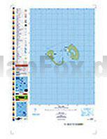
 | PI13 Manuae (Cookinseln) Topographische Landkarte 1:25.000 - Land Information New Zealand |
 | Kleine Kykladen - Irakleia - Schinousa - Koufonisia - Donousa (Blatt 10.36) Topografische Wanderkarte griechische Inseln - Ägäis - 1:25.000 - Anavasi - Griechenland |
 | 3336 Groß Schwechten Topographische Karte 1:25.000 Landesamt für Vermessung und Geoinformation Sachsen-Anhalt (Landesvermessungsamt) |
 | 3531ET SAINT-GERVAIS-LES-BAINS Topographische Wanderkarte Frankreich 1:25.000 TOP 25 IGN |
 | 2048OT AULUS LES BAINS - Mont Valier Topographische Wanderkarte Frankreich 1:25.000 TOP 25 IGN - (GPS) |
 | Albanien 1:400.000 Auto- und Freizeitkarte Shiqiperia freytag & berndt |
 | Kaukasus - Georgien - Armenien - Aserbaidschan Auto- und Freizeitkarte 1:700.000 freytag & berndt |
 | 06 Bassa Valle Camonica - Alto Lago d`Iseo 1:25.000 - Valle Camonica - La Valle dei Segni - Wanderkarte - Ingenia Editori - Italien |
 | 3540ET HAUTE VALLEE DU VAR Topographische Wanderkarte Frankreich 1:25.000 TOP 25 IGN - (GPS) |
 | 3044OT CAMARGUE - PORT-ST-LOUIS-DU-RHôNE Topographische Wanderkarte Frankreich 1:25.000 TOP 25 IGN |
 | 3531OT MEGEVE / COL DES ARAVIS Topographische Wanderkarte Frankreich 1:25.000 TOP 25 IGN |
 | Commonwealth of Dominica 1:40.000 - Landkarte - Street map - GMP - Geographic Map Publishing - midok - Michal Kasprowsky |
 | 2525 Hamburg-Harburg Topographische Landkarte 1:25.000 Landesvermessungsamt Schleswig-Holstein |
 | 1227 NIESEN 1:25.000 - Erlenbach i.S. - Diemtigtal - Frutigen - Topographische Landeskarte der Schweiz - swisstopo |
 | Windebyer Noor - Große Breite Topographische Wanderkarte mit Wanderwegen und Radwegen 1:25.000 Schleswig-Holstein - ProjektNord |
 | 1345OT CAMBO-LES-BAINS - Hasparren - Topographische Wanderkarte Frankreich 1:25.000 TOP 25 IGN - (GPS) |
 | TR09 Tasman Peninsola 1:50.000 Topographische Landkarte Tasmanien - Australien - Tasmap (Tasmanien) |
 | Aruba 1:28.000 - Landkarte - Street map - GMP - Geographic Map Publishing - midok - Michal Kasprowsky |
 | Mittelangeln Topographische Wanderkarte mit Wanderwegen und Radwegen 1:40.000 Schleswig-Holstein - ProjektNord |
 | 04 La Via dei Campioni 1:25.000 - Montaldo di Cosola - Rifugio Parco Antola - Rad- und Wanderkarte - Ingenia Editori - Italien Carta cicloescursionistica del tratto compreso tra Montaldo di Cosola e Rifugio Parco Antola sulla Via dei Campioni |