| << Cookinseln - Tokelau-Inseln - Niue - Kermadecinseln |
||
|
||
Zuletzt angesehene Artikel:
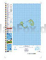
 | PI13 Manuae (Cookinseln) Topographische Landkarte 1:25.000 - Land Information New Zealand |
 | 284.23 Amtliche topographische Karte 1:25.000 Polen |
 | Afrika physisch-politisch 1:8 Mio. Magnetmarkiertafel freytag & berndt |
 | Wzgorza Dalkowskie Touristenkarte 1:75.000 WZGÃRZA DALKOWSKIE PLAN Galileos - Polen |