| << Cookinseln - Tokelau-Inseln - Niue - Kermadecinseln |
||
|
||
Zuletzt angesehene Artikel:
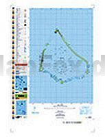
 | PI10 Manihiki (Cookinseln) Topographische Landkarte 1:25.000 - Land Information New Zealand |
 | 244 Cannock Chase & Chasewater - Stafford Rugeley & Cannock - Wanderkarte GroÃbritannien 1:25.000 EXPLORER MAP - Ordnance Survey |
 | Berlin und Umgebung ADFC-Regionalkarte 1:75.000 BVA Bielefelder Verlag |
 | Gebrauchsanweisung für Griechenland - von Martin Pristl - Piper Verlag |
 | Hebräisch - Wort für Wort Kauderwelsch-Sprachführer (Band 037) Israel - Reise-Know-How Verlag |
 | OL62 Coreen Hills & Glenlivet - Wanderkarte GroÃbritannien 1:25.000 EXPLORER MAP - Ordnance Survey |
 | Val di Sole 1:35.000 (Blatt 119) - Wanderkarte mit Broschüre KOMPASS |
 | Ramat del Nord trekking 1:50.000 Wanderkarte + Wanderführer Spanien - ALPINA |
 | Unteres Warnowland Rad- und Wanderkarte 1:30.000 - Grünes Herz |
 | 5629 Römhild Topographische Karte Thüringen 1:25.000 Landesvermessungsamt Thüringen |
 | Bad Gandersheim 1:25.000 Radwanderführer Harz KKV - Kartographische Kommunale Verlagsgesellschaft |
 | Fischland, Darss und Zingst - ein Reiseführer Kultur- und Landschaftsführer - von Roland Buchwald - Grünes Herz |
 | 4049-SO Topographische Karte 1:10.000 - Landesvermessungsamt Brandenburg |
 | Potsdam Mit Ausflügen nach Werder und ins Havelland - von Kristine Jaath - TRESCHER |
 | Warschau und Umgebung - Stadtatlas 1:20.000 Warszawa i okolice - DEMART Polen |
| 3049-SO Topographische Karte 1:10.000 - Landesvermessungsamt Brandenburg |
 | Oh, dieses Ãsterreichisch! Fremdsprech (Band 910) - Dippelreither Conrad-Stein-Verlag |
| 3847-SO Topographische Karte 1:10.000 - Landesvermessungsamt Brandenburg |
 | 6708 St. Johann Topographische Karte 1:25.000 - Landesvermessungsamt Saarland |
 | Pfälzerwald 5 Topographische Wanderkarte Rheinland-Pfalz mit Wanderwegen und Radwegen 1:25.000 - ProjektNord |