| << Cookinseln - Tokelau-Inseln - Niue - Kermadecinseln |
||
|
||
Zuletzt angesehene Artikel:
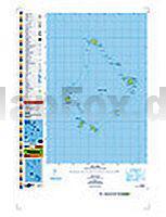
 | PI07 Palmerston (Cookinseln) Topographische Landkarte 1:25.000 - Land Information New Zealand |
 | 10173 Svanvik Topographische Landkarte 1:50.000 Norge-serien - Nordeca Norwegen |
 | Oppeln plus 3 Stadtplan 1:17 000 (Krappitz, Neisse, Gr. Strehlitz) Opole plus 3 (Krapkowice, Nysa, Strzelce Opolskie) - DEMART - Polen |
 | Snowdonia National Park pocket map 1:120.000 Pocket map - National Parks UK and Collins Maps |
 | Fischland, Darss und Zingst - ein Reiseführer Kultur- und Landschaftsführer - von Roland Buchwald - Grünes Herz |
 | 08/1-2 HOOGSTRATEN NGI 1:25.000 Topographische Landkarte Belgien |
 | Saint Nicholas Ways (Türkei) Wanderführer (englisch, türkisch) Aziz Nicolaos Yolları Upcountry Türkei |
 | Flat Tops NE (Blatt: 122) Landkarte Trails Illustrated Map National Geographic - USA |
 | Top MTB Trails South Africa - Fahrradatlas Südafrika - MapStudio Südafrika |
 | Augsburg 2017 1:5.300/1:25.000 (Blatt 365) Bildstadtplan Bollmann-Bildkarten-Verlag |
 | Wye Valley - 40 Berg- & Flußuferwanderungen Englischsprachiger Wanderführer - POCKET MOUNTAINS LTD Wye Valley - 40 Hill and Riverside Walks - 40 circular routes |
 | 431.34 Nowogród Bobranski Amtliche topographische Karte 1:25.000 Polen |
 | 5141 Nationalpark Triglav - Kranjska Gora - Planica - Bled 1:35.000 - Wanderkarte mit Begleitheft - GPS - Freytag & Berndt |
 | New York State Straßenkarte 1:1.25 Mio. (wasserfest - reißfest) GuideMap National Geographic - USA |
 | Mainz und Rheinhessen mit Kindern Ausflüge & Aktivitäten rund ums Jahr von Philipp Wohltmann - FREIZEITFÜHRER MIT KINDERN pmv Peter Meyer Verlag |
| Republik Usbekistan - Landkarte 1:1.6 Mio. Ozbekiston Respublikasi - Usbekistan |
 | 18 Peak District Cycle Map 1:100.000 Manchester, Leeds, Derby and Sheffield - Cycle Maps UK - Lovell Johns |
| 3336ET LES DEUX ALPES/PARC DES ECRINS Topographische Wanderkarte Frankreich 1:25.000 TOP 25 IGN - (GPS) |
 | Straßenatlas Europa 1:1.5 Mio. Evropa autoatlas SHOCart |
 | 5805 Mürlenbach Topographische Karte 1:25.000 - Landesamt für Vermessung und Geobasisinformation Rheinland-Pfalz |