| << Cookinseln - Tokelau-Inseln - Niue - Kermadecinseln |
||
|
||
Zuletzt angesehene Artikel:
 | PI06 Nassau (Cookinseln) Topographische Landkarte 1:25.000 - Land Information New Zealand |
 | Bündner Alpen Band 3 Avers (San Bernardino bis Septimer) Alpinführer Schweizer Alpen Schweizer Alpen-Club |
 | 6809 Gersheim Topographische Karte 1:25.000 - Landesvermessungsamt Saarland |
 | 803 Oberes Nahetal 1:40.000 Rad- und Wanderkarte Rundwanderwege mit Beschreibung auf der Rückseite GW Rheingau-Taunus-Kartographie |
 | Ile-de-France à vélo (100 Circuits) Fahrradkarte 1:100.000 - IGN Frankreich |
 | 21 Strangford Lough - Wanderkarte Nord-Irland 1:50.000 DISCOVERER MAP - Ordnance Survey |
 | Fischland Darà Zingst Entdeckungen auf Deutschlands schönster Halbinsel - von Scheddel, Klaus - via reise |
 | Lainsitz - Wassersportkarte 1:50.000 Lužnice - Vodácká Mapa - SHOCart - Tschechien |
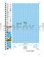
 | PI14 Takutea (Cookinseln) Topographische Landkarte 1:25.000 - Land Information New Zealand |
 | Deutschland Süd Autokarte + Freizeitkarte 1:500.000 freytag & berndt |
 | Sudetenland gestern - Kalender 2011 *** SCHNÃPPCHEN *** Format 29 x 32 cm m+m Verlag |
 | 6508 Ottweiler Topographische Karte 1:25.000 - Landesvermessungsamt Saarland |
 | Spanien Nord - Jakobsweg - mit Informationsbroschüre - Autokarte 1:400.000 Freytag & Berndt |
 | Hocharabisch - Wort für Wort Kauderwelsch-Sprachführer (Band 76) Reise-Know-How Verlag |
 | Dippoldiswalde - Kreischa - Dohna (Blatt 37) Topographische Wanderkarte 1:30.000 mit Wanderwegen - ProjektNord |
 | 179 Cheltenham - Gloucester & Stroud - Wanderkarte GroÃbritannien 1:25.000 EXPLORER MAP - Ordnance Survey |
 | La Palma 1:50.000 - Supertrail Map - Mountainbikekarte - Landkarte outcomm |
 | Romani - Wort für Wort Kauderwelsch-Sprechführer (Band 177) Reise-Know-How Verlag |
 | San Sebastián und Bilbao - CityTrip Reiseführer mit Faltplan. Mit Gratis-App - von Hans-Jürgen Fründt - Reise Know-How |
 | 484.24 Pilchowice Amtliche topographische Karte 1:25.000 Polen |