| << Cookinseln - Tokelau-Inseln - Niue - Kermadecinseln |
||
|
||
Zuletzt angesehene Artikel:
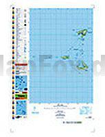
 | PI05 Pukapuka (Cookinseln) Topographische Landkarte 1:25.000 - Land Information New Zealand |
 | 234.23 Amtliche topographische Karte 1:25.000 Polen |
 | Toskana StraÃenkarte Local 1:200.000 (Blatt 358) Michelin Italien Toscana |
| 223.11 Amtliche topographische Karte 1:25.000 Polen |
| 173.14 Amtliche topographische Karte 1:25.000 Polen |
| 326.12 Amtliche topographische Karte 1:25.000 Polen |
 | 182 St Albans & Hatfield - Wanderkarte GroÃbritannien 1:25.000 EXPLORER MAP - Active Map LAMINIERT - Ordnance Survey |
| 212.31 Amtliche topographische Karte 1:25.000 Polen |
 | Historische Karte: SOWJETUNION 1951 (gerollt) Verlag Rockstuhl |
 | DuMont direkt Reiseführer Miami Key West & Everglades - von Sebastian Moll - DuMont Reiseverlag |
 | Wanderkarte Nationalpark Hainich - Biotop Wanderkarte - grünes herz |
 | Bielatalgebiet Wanderkarte 1:10.000 - Rolf Böhm Verlag |
 | 03 Chamonix-Mont-Blanc - Trient - Courmayeur 1:25.000 Wanderkarte mit Begleitheft - l`Escursionista Editore Carta dei sentieri di Chamonix-Mont-Blanc - Trient e Courmayeur con guida escursionistica |
 | 2839OT BESSEGES - LES VANS Topographische Wanderkarte Frankreich 1:25.000 TOP 25 IGN |
 | Mit dem Wohnmobil durch England & Wales Unterwegs zuhause - von Pöppelmann, Christa - Kunth Verlag |
| 173.21 Amtliche topographische Karte 1:25.000 Polen |
 | Hohe Mark Radroute Radeln zwischen Münsterland, Niederrhein und Ruhrgebiet, 1:50.000, 279 km, GPS-Tracks Download, LiveUpdate - Esterbauer |
| 461.12 Gryfow Slaski Amtliche topographische Karte 1:25.000 Polen |
| Canton / Massillon / Stark County Stadtplan 1:32.000 (Ohio - USA) Canton / Massillon / Stark County street map GM Johnson |
| 214.4 Olecko Amtliche topographische Karte 1:50.000 Polen |