| << Cookinseln - Tokelau-Inseln - Niue - Kermadecinseln |
||
|
||
Zuletzt angesehene Artikel:
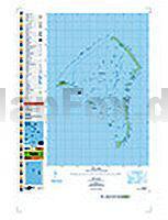
 | PI03 Fakaofo (Tokelau-Inseln) Topographische Landkarte 1:25.000 - Land Information New Zealand |
 | Abi Gamin - Kamet (Himalaya) 1:150.000 (E. Garhwal - Northern India) SCHWEIZERISCHE STIFTUNG |
 | Vall de Camprodon - Vall de Ribes - Nuria - Ulldeter E50 1:50.000 Wanderkarte Spanien - ALPINA |
 | Disko-Bucht 1:250.000 (Blatt 5) Laminierte Regionalkarte Kort 5: DISKOBUGTEN / Disko Bay Arctic Sun Maps - Grönland |
 | Urlaub in der Natur in Lettland, Litauen und Estland 1:1 Mio (englisch / lettisch) Dabas Brivdienas Latvija, Lietuva, Igaunija / Nature Holidays Map Latvia, Lithuania, Estonia Lauku Celotajs - Baltic Country Holidays |
 | Südgrönland 1:250.000 (Blatt 2) Laminierte Regionalkarte Kort 2: SYDGRØNLAND / South Greenland - Kalaallit Nunaata Kujataa Arctic Sun Maps - Grönland |