| << Cookinseln - Tokelau-Inseln - Niue - Kermadecinseln |
||
|
||
Zuletzt angesehene Artikel:
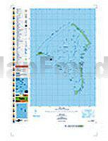
 | PI03 Fakaofo (Tokelau-Inseln) Topographische Landkarte 1:25.000 - Land Information New Zealand |
 | Mit Bahn und Bus in die Münchner Berge - 55 Touren zwischen Füssen und Berchtesgaden Rother Wanderbuch - Bergverlag Rother |
 | OL10 Arundel & Pulborough - Wanderkarte GroÃbritannien 1:25.000 EXPLORER MAP - Ordnance Survey |
 | Rostock- Güstrow *** SCHNÃPPCHEN *** Fahrradkarte 1:75.000 - Grünes Herz |
 | 10/5-6 BEVERBEEK NGI 1:25.000 Topographische Landkarte Belgien |
 | 461.1 Lesna Amtliche topographische Karte 1:50.000 Polen |
 | 2047OT SAINT-GIRONS/COUSERANS Topographische Wanderkarte Frankreich 1:25.000 TOP 25 IGN - (GPS) |
 | TL05 Murchison 1:50.000 Topographische Landkarte Tasmanien - Australien - Tasmap (Tasmanien) |
| 215.13 Przerosl-Osada Amtliche topographische Karte 1:25.000 Polen |
 | Elsässisch - Wort für Wort Kauderwelsch-Sprachführer (Band 116) Reise-Know-How Verlag |
 | Kungsleden - Trekking in Schweden - Wanderführer In 28 Tagestouren von Abisko nach Hemavan - von Claes Grundsten - Reise Know-How |
 | 1518 Südfall Topographische Landkarte 1:25.000 Landesvermessungsamt Schleswig-Holstein |
 | Entre el Valle y las Cumbres Literatura Munanya - Editorial Piolet - Spanien |
 | 6: Nord-Schweden Nord: Lulea - Kiruna - Narvik 1:400.000 - Kümmerly & Frey |
 | Bosnia & Herzegovina Travel Guide Reiseführer (englisch) Bradt Publications |
 | Rhön E-Bikekarte ADFC-Regionalkarte 1:75.000 BVA Bielefelder Verlag |
 | 21/3-4 AALTER - NEVELE NGI 1:25.000 Topographische Landkarte Belgien |
 | 235 Wisbech & Peterborough North - Wanderkarte GroÃbritannien 1:25.000 EXPLORER MAP - Active Map LAMINIERT - Ordnance Survey |
 | Morbihan 30 balades à pied Wanderführer - (französisch) Chamina - Frankreich |
 | Glarnerland Kletterführer - von Leuzinger, SamuelThomas, Wälti - SAC-Verlag Schweizer Alpen-Club |