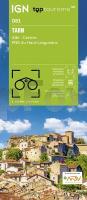
 Straßenkarte Departement Frankreich. Dies ist eine hochwertige Kartenserie, die sich besonders zum Radwandern und zum Weitwandern eignet. Die topographischen Karten enthalten Radwanderwege, überregionale Wanderwege und touristische Informationen.  Blattschnitte der Serie
Die Blätter reichen jeweils mindestens an den äußeren Rand eines Départements und sind entsprechend der Départements numeriert. Bereiche benachbarter Départements sind in gleicher Weise dargestellt, soweit der Blattschnitt reicht. Kartenbeispiel aus der Serie Kartenausschnitt
|
TARN (Blatt D81) Département-Landkarte Frankreich 1:100.000
TARN - Carte départementale - IGN Frankreich
EAN / ISBN: 9782758555667
Preis: EUR 11.90
|
|



