
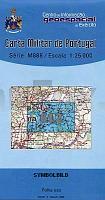
| << Portugal: Amtliche topografische Landkarten des Instituto Geográfico do Exército (IGeoE) 1:25.000 (Serie M888) |
||
|
||


Zuletzt angesehene Artikel:
 | 612 Fuseta (Olhao) Topographische Landkarte Portugal 1:25.000 Carta Militar de Portugal - Série M888 Instituto Geográfico do Exército (IGeoE) - Portugal |
 | 492-4 MARTÍN DEL RÍO Amtliche topographische Landkarte 1:25.000 Spanien (M.T.N.) 492-4 Mapa Topográfico Nacional de Espana (MTN25) Instituto Geográfico Nacional - CNIG Spanien |
 | NM 33-11-30 Ost (4330-Ost) Neulengbach Österreichische Karte 1:25.000 mit Wegmarkierungen (topographische Wanderkarte - UTM) - BEV - Österreich - Vergrößerung (ÖK25V) |
 | 41 Geraz do Lima (Viano do Castelo) - Topographische Landkarte Portugal 1:25.000 Carta Militar de Portugal - Série M888 Instituto Geográfico do Exército (IGeoE) - Portugal |
 | 2184 Simnau Topographische Karte 1:25.000 Messtischblatt des Deutschen Reiches - Preußische Landesaufnahme / Reichsamt für Landesaufnahme - Faksimile ProjektNord |
 | 2513-I-NØ Topographische Karte Dänemark 1:25.000 Topografisk kort Danmark (DTK/Kort25) 2513-I-NØ ProjektNord - Kort & Matrikelstyrelsen / Geodætisk Institut |
 | 505-4 SOLANA DE RIOALMAR Amtliche topographische Landkarte 1:25.000 Spanien (M.T.N.) 505-4 Mapa Topográfico Nacional de Espana (MTN25) Instituto Geográfico Nacional - CNIG Spanien |
 | 541 Topographische Landkarte Wanderkarte und Fahrradkarte Portugal 1:25.000 541 Mapa topográfico - Mapa de caminhadas - Portugal 1:25.000 ProjektNord |
 | NL 33-02-12 Ost (4212-Ost) Gloggnitz Österreichische Karte 1:25.000 mit Wegmarkierungen (topographische Wanderkarte - UTM) - BEV - Österreich - Vergrößerung (ÖK25V) |
 | 2112 01 Rutava Topographische Karte 1:20.000 (Maastokartta / Peruskartta / Grundkarta) Maanmittauslaitos / Lantmäteriverket Finnland - ProjektNord |
 | Peloponnes - Landkarte und Touristenführer Regionale Landkarte 1:250.000 Orama - Griechenland Πελοπόννησος - Peloponnese - Map & Guide |
 | 907 (21-36) Villacarrillo Amtliche topographische Landkarte 1:50.000 Spanien (M.T.N.) 907 Mapa Topográfico Nacional de Espana (MTN50) Instituto Geográfico Nacional - CNIG Spanien |
 | 0234-3 MELGAR DE ABAJO Topographische Landkarte 1:25.000 Spanien (Grundlage MTN25) Instituto Geográfico Nacional - CNIG Spanien - ProjektNord |
| M-33-18-A/B Leknica Amtliche topographische Landkarte Polen 1:50.000 M-33-18-A/B Leknica - Mapa Topograficzna Polski Glowny Geodeta Kraju |
 | 757-1 SIETE VENADOS Amtliche topographische Landkarte 1:25.000 Spanien (M.T.N.) 757-1 Mapa Topográfico Nacional de Espana (MTN25) Instituto Geográfico Nacional - CNIG Spanien |
 | 695-4 RIBA-ROJA DE TÚRIA Amtliche topographische Landkarte 1:25.000 Spanien (M.T.N.) 695-4 Mapa Topográfico Nacional de Espana (MTN25) Instituto Geográfico Nacional - CNIG Spanien |
 | 1023-3 BOBADILLA-ESTACION Amtliche topographische Landkarte 1:25.000 Spanien (M.T.N.) 1023-3 Mapa Topográfico Nacional de Espana (MTN25) Instituto Geográfico Nacional - CNIG Spanien |
 | 0396-2 ALMARAZ DE DUERO Topographische Landkarte 1:25.000 Spanien (Grundlage MTN25) Instituto Geográfico Nacional - CNIG Spanien - ProjektNord |
 | 636-4 VILLAR DEL HUMO Amtliche topographische Landkarte 1:25.000 Spanien (M.T.N.) 636-4 Mapa Topográfico Nacional de Espana (MTN25) Instituto Geográfico Nacional - CNIG Spanien |
 | 735-3 FONTANAREJO Amtliche topographische Landkarte 1:25.000 Spanien (M.T.N.) 735-3 Mapa Topográfico Nacional de Espana (MTN25) Instituto Geográfico Nacional - CNIG Spanien |