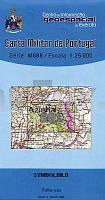
| << Portugal: Amtliche topografische Landkarten des Instituto Geográfico do Exército (IGeoE) 1:25.000 (Serie M888) |
  | |
|
||
Zuletzt angesehene Artikel:
![]() | 591 Azinhal (Castro Marim) Topographische Landkarte Portugal 1:25.000 Carta Militar de Portugal - Série M888 Instituto Geográfico do Exército (IGeoE) - Portugal |
![]() | Estland Straßenkarte 1:560.000 laminiert Eesti - maanteede kaart Jana Seta |
![]() | 3137 Hansestadt Werben (Elbe) Sonderausgabe mit Wanderwegen - Topographische Wanderkarte Brandenburg 1:25.000 ProjektNord |
![]() | 3046 Zehdenick Sonderausgabe mit Wanderwegen - Topographische Wanderkarte Brandenburg 1:25.000 ProjektNord |
![]() | 3037-SW Topographische Karte 1:10.000 - Landesvermessungsamt Brandenburg |
![]() | 6026 Werneck Topographische Landkarte Bayern 1:25.000 - Normalausgabe - ProjektNord (geplottete Ausgabe) - Grundlage amtliche Topographische Karte Bayern DTK25 |
![]() | 360 - Topographische Landkarte Portugal 1:25.000 Carta Militar de Portugal - Série M888 Instituto Geográfico do Exército (IGeoE) - Portugal |
![]() | Milford & Kepler Recreation Areas 1:50.000 Wanderkarte Terralink - Neuseeland |
![]() | Omloop twee Vlaanders - Fahrradkarte 1:20.000 Touristische Radwanderkarte Belgien NGI Belgien |
![]() | 5931 Ebensfeld Topographische Landkarte Bayern 1:25.000 - Normalausgabe - ProjektNord (geplottete Ausgabe) - Grundlage amtliche Topographische Karte Bayern DTK25 |
![]() | 502 Dreiländereck Tschechien - Österreich - Deutschland 1:50.000 SHOCart - Tschechien Trojmezi Cesko - Rakousko - Nemecko |
![]() | Bergstraße-Odenwald, Neckartal, 2-teiliges Set mit Aktivguide, GPS - Wanderkarten-Set mit Aktivguide (Blatt 827) KOMPASS |
![]() | 105O14 Marmot Creek - Yukon Territory Topographische Landkarte 1:50.000 - Canada - Yukon |
![]() | 10038 Voss Topographische Landkarte 1:50.000 Norge-serien - Nordeca Norwegen |
![]() | 4648 Ortrand Sonderausgabe mit Wanderwegen - Topographische Wanderkarte Brandenburg 1:25.000 ProjektNord |
![]() | 3044 Großmutz Sonderausgabe mit Wanderwegen - Topographische Wanderkarte Brandenburg 1:25.000 ProjektNord |
![]() | Alytus-Region (Süd-Litauen) Touristische Landkarte 1:120.000 Dzukija - Briedis - Litauen |
![]() | T5321 Liikasenvaara Topographische Karte 1:25.000 EUREF (Peruskartta) Maanmittauslaitos / Lantmäteriverket Finnland - ProjektNord |
![]() | L3122 Walsrode (geplottete Ausgabe) Topographische Karte 1:50.000 Kartografie Landesvermessungsamt Niedersachsen - ProjektNord |


