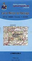
| << Portugal: Amtliche topografische Landkarten des Instituto Geográfico do Exército (IGeoE) 1:25.000 (Serie M888) |
||
|
||

Zuletzt angesehene Artikel:
 | 581 Cachopo (Tavira) Topographische Landkarte Portugal 1:25.000 Carta Militar de Portugal - Série M888 Instituto Geográfico do Exército (IGeoE) - Portugal |
 | Bieszczady - Touristische Attraktionen 1:100.000 Touristische Wanderkarte Polen Bieszczady - mapa atrakcji turystycznych Compass - Polen |
 | Wotschwien See 1:15.000 Touristische Wanderkarte, Wassersportkarte mit Tiefenprofilen - Polen Jezioro Woświn - mapa batymetryczna GPS 3D EKO-Map - Polen |
 | 1039 (17-43) Colmenar Amtliche topographische Landkarte 1:50.000 Spanien (M.T.N.) 1039 Colmenar Mapa Topográfico Nacional de Espana (MTN50) Instituto Geográfico Nacional - CNIG Spanien |
 | 1426 Damp - Gestern und Heute - Historische Ãberlagerung 1932-1950 Topographische Landkarte 1:25.000 im Vergleich - Landesvermessungsamt Schleswig-Holstein / ProjektNord |
 | 2: Ostflandern und Hennegau Wanderkarte 1:85.000 GR Oost-Vlaanderen & Henegouwen wandelkaart Alta Via - Belgien |
 | 5923 Rieneck Topographische Landkarte Bayern 1:25.000 - Normalausgabe - ProjektNord (geplottete Ausgabe) - Grundlage amtliche Topographische Karte Bayern DTK25 |
 | Donaulaufkarte mit Südosteuropa 1683 - Historische Landkarte Nachdruck Planokarte - gerollt von Sandrart, Jacob - Verlag Rockstuhl |
 | Polen StraÃenkarte 1:650.000 (aktuelle Jahresausgabe) StraÃenkarte - Papierausgabe Polska mapa samochodowa (wyd. pap.) Compass - Polen |
| 16 Norte Grande - S. Jorge (Azoren) - Topografische Karte Portugal 1:25.000 Carta Militar de Portugal - Série M889 - 1/25 000 (Acores) - Instituto Geográfico do Exército (IGeoE) - Portugal |
 | 7 Horta (Faial südost / Pico west - Azoren) - Topographische Karte Portugal 1:25.000 Carta Militar de Portugal - Série M889 - 1/25 000 (Acores) - Instituto Geográfico do Exército (IGeoE) - Portugal |
 | 901 Villaviciosa de Córdoba Amtliche topographische Landkarte 1:50.000 Spanien (M.T.N.) 901 Mapa Topográfico Nacional de Espana (MTN50) Instituto Geográfico Nacional - CNIG Spanien |
 | 1 Grand Bruxelles / Groot Brussel 1:50.000 - hike & bike map Touristische Landkarte und Wanderkarte, Radwanderkarte - Mini Ardenne - Belgien |
 | Hennegau Fahrradrouten (Blatt 604) 1:100.000 / 1:135.000 DeRouck - Geocart Belgien Circuits Cyclistes Hainaut / Fietsroutes Henegouwen |
 | Karelische Landenge - Reisekarte 1:140.000 / 1:30.000 Karta LTD Sankt Petersburg Karelskij perescheek dlja puteschestwenniko |
 | Polen: StraÃenkarte mit Touristischen Sehenswürdigkeiten 1:685.000 - Touristische Landkarte Polska Atrakcje Turystyczne mapa samochochodowa-turystyczna ExpressMap Polen |
| 4372 Ostrowo Topographische Karte 1:25.000 Messtischblatt des Deutschen Reiches - PreuÃische Landesaufnahme / Reichsamt für Landesaufnahme - Faksimile ProjektNord |
 | 4104 (NL 33-05-04) Deutschlandsberg Topographische Wanderkarte 1:50.000 mit Wegmarkierungen - Ãsterreich - Kartographie BEV - ProjektNord |
 | Köln Nordost - Bergisch Gladbach Topographische Wanderkarte Nordrhein-Westfalen mit Wanderwegen und Radwegen 1:25.000 - ProjektNord |
 | Klosterbezirk Altzella - zwischen Nossen - Reinsberg und Hainichen, Freiberger Land - Augustusburger Land Wanderkarte und Radwanderkarte mit Reitwegen 1:33.000 - wasserfest - reiÃfest - Sachsen Kartographie (Blatt 45) |