| << Portugal: Amtliche topografische Landkarten des Instituto Geográfico do Exército (IGeoE) 1:25.000 (Serie M888) |
||
|
||

Zuletzt angesehene Artikel:
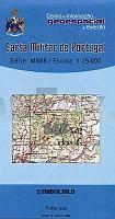
 | 565 - Topographische Landkarte Portugal 1:25.000 Carta Militar de Portugal - Série M888 Instituto Geográfico do Exército (IGeoE) - Portugal |
 | L4544 Torgau Topographische Karte 1:50.000 (Regelblattschnitt) Landesvermessungsamt Brandenburg |
 | U5132 Nousu Topographische Karte 1:25.000 EUREF (Peruskartta) Maanmittauslaitos / Lantmäteriverket Finnland - ProjektNord |
 | 288 Bradford & Huddersfield - Wanderkarte GroÃbritannien 1:25.000 EXPLORER MAP - Ordnance Survey |
| 5150 Rosenthal-Bielatal Amtliche Topographische Landkarte 1:25.000 (Präsentationsgrafik) - Landesvermessungsamt Sachsen |
 | 3101 (NL 33-04-01) Sankt Jakob in Defereggen Topographische Wanderkarte 1:50.000 mit Wegmarkierungen - Ãsterreich - Kartographie BEV - ProjektNord |
 | 2212-I Haderslev - mit Wanderwegen und Fahrradrouten Topographische Fahrradkarte und Wanderkarte Dänemark 1:50.000 - Kort & Matrikelstyrelsen ProjektNord 2212-I Haderslev - Topografisk Cykel- og Vandrekort Danmark |
 | Toscana *** SCHNÃPPCHEN *** Reiseführer Reise-Know-How Verlag |
 | 10073 Folldal Topographische Landkarte 1:50.000 Norge-serien - Nordeca Norwegen |
 | Celje Stadtplan Kartografija - Slowenien 1:13.000 City Map of Celje / Mestina Karta |
 | 5308 (NM 33-12-08) Laa an der Thaya Topographische Wanderkarte 1:50.000 mit Wegmarkierungen - Ãsterreich - Kartographie BEV - ProjektNord |
 | 5727 Münnerstadt Topographische Landkarte Bayern 1:25.000 - Normalausgabe - ProjektNord (geplottete Ausgabe) - Grundlage amtliche Topographische Karte Bayern DTK25 |
 | 4406 Dinslaken (geplottete Ausgabe) Amtliche topographische Karte 1:25.000 Landesvermessungsamt Nordrhein-Westfalen |
 | Kattowitz Stadtplan 1:20.000 Katowice plan miasta ExpressMap - Polen |
 | 147 - Topographische Landkarte Portugal 1:25.000 Carta Militar de Portugal - Série M888 Instituto Geográfico do Exército (IGeoE) - Portugal |
 | Wilde Wölfe Mein Leben mit den Letzten ihrer Art in Kanada. Vorw. v. Andreas Kieling. In Zus.-Arb. m. Chris Darimont. Von Ian McAllister - National Geographic Taschenbuch |
 | 3221 (NL 33-01-21) Zell am See Topographische Wanderkarte 1:50.000 mit Wegmarkierungen - Ãsterreich - Kartographie BEV - ProjektNord |
 | V5143 Topographische Karte 1:25.000 EUREF (Peruskartta) Maanmittauslaitos / Lantmäteriverket Finnland - ProjektNord |
 | Stettin - Pölitz - Swinemünde Stadtplan 1:22.000 Szczecin - Police - Świnoujście plan miasta ExpressMap - Polen |
| L-34-19-D Hajduszoboszlo Amtliche Topographische Karte Ungarn 1:50.000 |