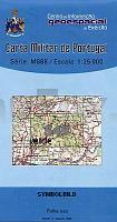
| << Portugal: Amtliche topografische Landkarten des Instituto Geográfico do Exército (IGeoE) 1:25.000 (Serie M888) |
||
|
||

Zuletzt angesehene Artikel:
 | 549 - Topographische Landkarte Portugal 1:25.000 Carta Militar de Portugal - Série M888 Instituto Geográfico do Exército (IGeoE) - Portugal |
 | 144 - Topographische Landkarte Portugal 1:25.000 Carta Militar de Portugal - Série M888 Instituto Geográfico do Exército (IGeoE) - Portugal |
 | 5047 Freital - Geologische Karte 1:25.000 (GK25 (N)) Grundlage Topographische Karte Sächsisches Landesamt für Umwelt, Landwirtschaft und Geologie |
 | 1062-I El Portal Amtliche topographische Landkarte 1:25.000 Spanien (M.T.N.) 1062-I Mapa Topográfico Nacional de Espana (MTN25) Instituto Geográfico Nacional - CNIG Spanien |
 | 1104-III Vega de San Mateo (Gran Canaria) Amtliche topographische Landkarte 1:25.000 Spanien (M.T.N.) 1104-III Mapa Topográfico Nacional de Espana (MTN25) Instituto Geográfico Nacional - CNIG Spanien |
 | 1029-3 Canjáyar Amtliche topographische Landkarte 1:25.000 Spanien (M.T.N.) 1029-3 Mapa Topográfico Nacional de Espana (MTN25) Instituto Geográfico Nacional - CNIG Spanien |
 | 837-4 VISO DEL MARQUÃS Amtliche topographische Landkarte 1:25.000 Spanien (M.T.N.) 837-4 Mapa Topográfico Nacional de Espana (MTN25) Instituto Geográfico Nacional - CNIG Spanien |
 | 578 Sao Marcos da Serra (Silves) Topographische Landkarte Wanderkarte und Fahrradkarte Portugal 1:25.000 578 Mapa topográfico - Mapa de caminhadas - Portugal 1:25.000 ProjektNord |
 | 4952 Schirgiswalde-Schluckenau (70) - Geologische Karte 1:25.000 (GK25) Grundlage Vollbornsche Ãquidistantenkarte Sächsisches Landesamt für Umwelt, Landwirtschaft und Geologie |
 | 267 - Topographische Landkarte Portugal 1:25.000 Carta Militar de Portugal - Série M888 Instituto Geográfico do Exército (IGeoE) - Portugal |
 | 375-1 Castrillo de la Vega Amtliche topographische Landkarte 1:25.000 Spanien (M.T.N.) 375-1 Mapa Topográfico Nacional de Espana (MTN25) Instituto Geográfico Nacional - CNIG Spanien |
 | 862-2 SIERRA DE SAN ANDRÃS Amtliche topographische Landkarte 1:25.000 Spanien (M.T.N.) 862-2 Mapa Topográfico Nacional de Espana (MTN25) Instituto Geográfico Nacional - CNIG Spanien |
| Erläuterungen zur Geologischen Karte 4751 Kloster St. Marienstern (37) - Ausgabe 1890 Sächsisches Landesamt für Umwelt, Landwirtschaft und Geologie |
 | 1064 (14-45) Cortes de la Frontera Amtliche topographische Landkarte 1:50.000 Spanien (M.T.N.) 1064 Mapa Topográfico Nacional de Espana (MTN50) Instituto Geográfico Nacional - CNIG Spanien |
 | 217-IV (72-20) Puigmal Amtliche topographische Landkarte 1:25.000 Spanien (M.T.N.) 217-IV Mapa Topográfico Nacional de Espana (MTN25) Instituto Geográfico Nacional - CNIG Spanien |
 | Fürstentümer Schwarzburg und Reuss 1864 - Historische Landkarte Nachdruck Planokarte - gerollt - Bearbeitet von C. Graf - Situation und Schrift von H. Szene. Terrain gezeichnet und grav. von V. Geyer - Verlag Rockstuhl |
 | 574-3 VILLANUEVA DE LA SIERRA Amtliche topographische Landkarte 1:25.000 Spanien (M.T.N.) 574-3 Mapa Topográfico Nacional de Espana (MTN25) Instituto Geográfico Nacional - CNIG Spanien |
 | 793-1 SAN BENITO Amtliche topographische Landkarte 1:25.000 Spanien (M.T.N.) 793-1 Mapa Topográfico Nacional de Espana (MTN25) Instituto Geográfico Nacional - CNIG Spanien |
 | 618 Cap Menorca y Ciutadela - Menorca Amtliche topographische Landkarte 1:50.000 Spanien (M.T.N.) 618 Mapa Topográfico Nacional de Espana (MTN50) Instituto Geográfico Nacional - CNIG Spanien |
 | Strømstad (Hvaler) - Mefjorden (Serie 02) Bootsportkarten 1:50.000 Bootsportkarten 1:50.000 - Nordeca Norwegen 02 Strømstad (Hvaler) - Mefjorden Båtsportkart |