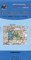
| << Portugal: Amtliche topografische Landkarten des Instituto Geográfico do Exército (IGeoE) 1:25.000 (Serie M888) |
||
|
||

Zuletzt angesehene Artikel:
 | 544 Vila Nova de Milfontes (Odemira) Topographische Landkarte Portugal 1:25.000 Carta Militar de Portugal - Série M888 Instituto Geográfico do Exército (IGeoE) - Portugal |
 | Moskau - öffentliche Verkehrsmittel (kyrillisch) 1:32.000 Stadtplan / StraÃenkarte / Touristenkarte - Russland Москва - Пассажирский транспорт Rus Co. Ltd. - Russland |
 | Kostroma - Oblast Kostroma 1:22.000 / 1:500.000 Stadtplan / StraÃenkarte / Touristenkarte Кострома - Костромская область Rus Co. Ltd. - Russland |
 | Nordböhmen - Schluckenau + Nationalpark Böhmische Schweiz 1:25.000 - Topographische Wanderkarte, Radkarte und Skikarte Český sever Šluknovsko a NP České Švýcarsko EUROKART (Tschechien) |
 | Ungarische Ober-Theià (Blatt A: 744-633 fkm) Tiszabecs - Zsurk 1:60.000 Wassersportkarte und Fahrradkarte Ungarn A Magyarországi Felső-Tisza Tiszabecs - Zsurk (A) - vÃzitúra- és kerékpáros térkép Kovács Térképmühely |
 | Isergebirge - Riesengebirge: Isergebirgs-Vorland - Hirschberger Tal 1:50.000 Touristische Landkarte und Wanderkarte Polen Góry Izerskie, Karkonosze: Pogórze Izerskie, Kotlina Jeleniogórska CartoMedia (Sygnatura) Polen |
 | Cantal, coeur de massif à pied - Auvergne Wanderführer - Mountainbikeführer (französisch) Cantal, coeur de massif à pied - Auvergne - Incontournables à pied Chamina - Frankreich |
 | Auvergne paysages & milieux naturels à pied - Auvergne Wanderführer - Mountainbikeführer (französisch) Auvergne paysages & milieux naturels à pied - Auvergne - Découverte du patrimoine - glossaire illustré, atlas, adresses Chamina - Frankreich |
 | Pogórze Strzyzowskie - Jaslo, Krosno, Dukla (Vorgebirge der Mittleren Beskiden) Touristische Landkarte 1:50.000 Wanderkarte, Wintersportkarte - wasserfest Pogórze Strzyzowskie - Jaslo, Krosno, Dukla (wyd. lamin.) Compass - Polen |
 | Nordost-Island und Ost-Island (Blatt 3) *** SCHNÃPPCHEN *** - Touristische Landkarte 1:250.000 Norðaustur- og Austurland ferðakort 3 Landmælingar - Island |
 | Kursk - Oblast Kursk 1:20.000 / 1:350.000 Stadtplan / StraÃenkarte / Touristenkarte Курск - Курская область Rus Co. Ltd. - Russland |
 | Erzgebirge - Region Jáchymov (Blatt 114) - Abertamy - BožÃ Dar - Jáchymov - Johanngeorgenstat - KlÃnovec - Kovářská - Kurort Oberwiesenthal - Ostrov - Topographische Wanderkarte 1:25.000 EUROKART (tschechisch) Krušné hory - Erzgebirge, Jáchymovsko Geodezie On Line - Tschechien |