| << Portugal: Amtliche topografische Landkarten des Instituto Geográfico do Exército (IGeoE) 1:25.000 (Serie M888) |
||
|
||

Zuletzt angesehene Artikel:
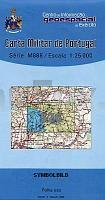
 | 526 - PROVENÃA Topographische Landkarte Portugal 1:25.000 Carta Militar de Portugal - Série M888 Instituto Geográfico do Exército (IGeoE) - Portugal PROVENÃA |
 | Sokoró - Cuha Völgye 1:50.000 / 1:15.000 Wanderkarte, Radwanderkarte, Freizeitkarte Sokoró, Szemere, Csanak, Pannonhalma, Cuha-Völgye, Fenyöfö, Csesznek, Köris-hegy Szarvas - Faragó - Ungarn |
 | Ostseeküste (4) Karwen - GroÃendorf - Hela - Gdingen - Touristische Landkarte und Wanderkarte Polen 1:50.000 Wybrzeze Baltyku - Karwia - Wladyslawowo - Hel - Gdynia - EKO-GRAF Polen - EKO-GRAF Polen |
 | 1091-IV (Tenerife) La Montañeta Amtliche topographische Landkarte 1:25.000 Spanien (M.T.N.) 1091-IV Mapa Topográfico Nacional de Espana (MTN25) Instituto Geográfico Nacional - CNIG Spanien |
 | 636 (25-25) Carboneras de Guadazaón Amtliche topographische Landkarte 1:50.000 Spanien (M.T.N.) 636 Mapa Topográfico Nacional de Espana (MTN50) Instituto Geográfico Nacional - CNIG Spanien |
 | 570 Pereiras-Gare (Odemira) Topographische Landkarte Portugal 1:25.000 Carta Militar de Portugal - Série M888 Instituto Geográfico do Exército (IGeoE) - Portugal |
 | Nordkapp - Lille-Tamsøya - Sværholt - Seekarte Norwegische Küste 1:50.000 - (Blatt 104) Den Norske Kyst Sjøkart - Hovedkart (sjø) Statens Kartverk Sjø - Norwegen |
 | 489 Vila Alva (Cuba) - Topographische Landkarte Portugal 1:25.000 Carta Militar de Portugal - Série M888 Instituto Geográfico do Exército (IGeoE) - Portugal |
 | 609 Sagres (Vila do Bispo) Topographische Landkarte Portugal 1:25.000 Carta Militar de Portugal - Série M888 Instituto Geográfico do Exército (IGeoE) - Portugal |
 | Aurlands og Nærøyfjorden - Seekarte Norwegische Küste 1:50.000 - (Blatt 124) Den Norske Kyst Sjøkart - Hovedkart (sjø) Statens Kartverk Sjø - Norwegen |
 | Pilis + Visegrád-Berge - 4in1 Tourisenkarte, Fahrradkarte (wasserfest) - Topografische Wanderkarte Ungarn 1:40.000 Pilis - Visegrádi-hegység - PILIS AND VISEGRÃD 4in1 tourist and cycling map & guide (water- and tear resistant) - Cartographia |
 | Moskau - Die neue Grenze von Moskau - StraÃenatlas Атлас Подмосковье - Новая граница Москвы Atlas Print (Russland) |
| 10 Ilhas Desertas (Madeira) - Topografische Karte Portugal 1:25.000 Carta Militar de Portugal - Série P821 - 1/25 000 (Madeira) - Instituto Geográfico do Exército (IGeoE) - Portugal |
 | Cévenol et Tanargue - Au coeur des Cévennes d`Ardèche - Topocarte 1:30.000 - Réf. TC005 Topographische Wanderkarte - FFRP (Fédération française de randonnée pédestre) Frankreich |
 | 53 à rjäng 1:50.000 (wasserfest) *** SCHNÃPPCHEN *** Topographische Wanderkarte - Sverigeserien Topo50 - Schweden Norstedts |
 | 26 Bretanha (S. Miguel - Azoren) - Topografische Karte Portugal 1:25.000 Carta Militar de Portugal - Série M889 - 1/25 000 (Acores) - Instituto Geográfico do Exército (IGeoE) - Portugal |
 | 1054 (18-44) Vélez-Málaga Amtliche topographische Landkarte 1:50.000 Spanien (M.T.N.) 1054 Mapa Topográfico Nacional de Espana (MTN50) Instituto Geográfico Nacional - CNIG Spanien |
 | 27 S. Miguel (Candelaria - Azoren) - Topografische Karte Portugal 1:25.000 Carta Militar de Portugal - Série M889 - 1/25 000 (Acores) - Instituto Geográfico do Exército (IGeoE) - Portugal |
 | Sankt Petersburg - Ãffentliche Verkehrsmittel Minikarte 1:50.000 / 1:25.000 Санкт-Петербург - Мини-карта Городской транспорт Rus Co. Ltd. |
 | 566 Espirito Santo (Mertola) - Topographische Landkarte Portugal 1:25.000 Carta Militar de Portugal - Série M888 Instituto Geográfico do Exército (IGeoE) - Portugal |