
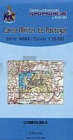
| << Portugal: Amtliche topografische Landkarten des Instituto Geográfico do Exército (IGeoE) 1:25.000 (Serie M888) |
||
|
||


Zuletzt angesehene Artikel:
 | 492 - Topographische Landkarte Portugal 1:25.000 Carta Militar de Portugal - Série M888 Instituto Geográfico do Exército (IGeoE) - Portugal |
 | M13: Foum Zguid - Tissint - PN d´Iriqui ouest - Jbel Bani Marokko Touristische Karte - von Conrad, A. +. B - Huber Kartographie |
 | Gorce (Westbeskiden) Wanderkarte 1:40.000 Landkarte - Wasserfeste Ausgabe Gorce (wyd. lamin.) Compass - Polen |
 | Land Swidnica (Schweidnitz) Touristenführer Illustrierter Führer mit Fotos und Karten Ziemia Świdnicka przewodnik PLAN Galileos - Polen |
 | 181-1 MONTARDO Amtliche topographische Landkarte 1:25.000 Spanien (M.T.N.) 181-1 Mapa Topográfico Nacional de Espana (MTN25) Instituto Geográfico Nacional - CNIG Spanien |
 | SENDER DE LA MEDITERRÀNIA Touristischer Wanderführer - Wanderkarte 1:50.000 GR 92 SUD De Vallvidrera (Barcelona) al Pont de Moliner (Ulldecona) Editorial Alpina Spanien |
 | 24 Angra do Heroísmo Insel Terceira (Azoren) - Topographische Karte Portugal 1:25.000 Carta Militar de Portugal - Série M889 - 1/25 000 (Acores) - Instituto Geográfico do Exército (IGeoE) - Portugal |
 | Böhmisches Mittelgebirge Ost (Verneřice) (Blatt 78) - Topographische Wanderkarte 1:25.000 Geodezie On Line - Tschechien České středohoří - Litoměřické středohoří - Porta Bohemica, úštěcká pahorkatina - Verneřické středohoří |
 | EuroVelo 6: Donau Radweg - von Budapest bis zum Schwarzen Meer 1:100.000 - Die offizielle EuroVeloRoute6 - Deutsche Gesellschaft für technische Zusammenarbeit |
 | 0568-3 ALCALÁ DE LA SELVA Topographische Landkarte 1:25.000 Spanien (Grundlage MTN25) Instituto Geográfico Nacional - CNIG Spanien - ProjektNord |
 | 471-2 MORA LA NOVA Amtliche topographische Landkarte 1:25.000 Spanien (M.T.N.) 471-2 Mapa Topográfico Nacional de Espana (MTN25) Instituto Geográfico Nacional - CNIG Spanien |
 | 0417-4 LESPLUGA DE FRANCOLÍ Topographische Landkarte 1:25.000 Spanien (Grundlage MTN25) Instituto Geográfico Nacional - CNIG Spanien - ProjektNord |
 | Südinsel Neuseeland & 6 Innenstadtpläne 1:1.5 Mio. / 1:20.000 (Blatt 25) Landkarte South Island & 6 City & Town Centres Maps Minimap 25 Kiwimaps Ltd - Neuseeland |
 | 588-3 VALDEMECA Amtliche topographische Landkarte 1:25.000 Spanien (M.T.N.) 588-3 Mapa Topográfico Nacional de Espana (MTN25) Instituto Geográfico Nacional - CNIG Spanien |
 | 11 Södra Gotland 1:50.000 (wasserfest) Topographische Wanderkarte - Sverigeserien Topo50 - Schweden Kartförlaget |
 | 392-2 CASTELLAR DEL VALLÉS Amtliche topographische Landkarte 1:25.000 Spanien (M.T.N.) 392-2 Mapa Topográfico Nacional de Espana (MTN25) Instituto Geográfico Nacional - CNIG Spanien |
 | Ytre Kiberg - Vadsø - Seekarte Norwegische Küste 1:50.000 - (Blatt 114) Den Norske Kyst Sjøkart - Hovedkart (sjø) Statens Kartverk Sjø - Norwegen |
 | 0701-4 VALENCIA DE ALCÁNTARA Topographische Landkarte 1:25.000 Spanien (Grundlage MTN25) Instituto Geográfico Nacional - CNIG Spanien - ProjektNord |
 | TARN-ET-GARONNE (Blatt D82) Département-Landkarte Frankreich 1:100.000 TARN-ET-GARONNE - Carte départementale - IGN Frankreich |
 | 409-4 CALATAYUD Amtliche topographische Landkarte 1:25.000 Spanien (M.T.N.) 409-4 Mapa Topográfico Nacional de Espana (MTN25) Instituto Geográfico Nacional - CNIG Spanien |