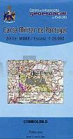
| << Portugal: Amtliche topografische Landkarten des Instituto Geográfico do Exército (IGeoE) 1:25.000 (Serie M888) |
||
|
||

Zuletzt angesehene Artikel:
 | 483-A - Topographische Landkarte Portugal 1:25.000 Carta Militar de Portugal - Série M888 Instituto Geográfico do Exército (IGeoE) - Portugal |
 | 0752-1 CORDOBILLA DE LÃCARA Topographische Landkarte 1:25.000 Spanien (Grundlage MTN25) Instituto Geográfico Nacional - CNIG Spanien - ProjektNord |
 | 0324-2 SESA Topographische Landkarte 1:25.000 Spanien (Grundlage MTN25) Instituto Geográfico Nacional - CNIG Spanien - ProjektNord |
 | 116 Glatz - Münsterberg Karte des Deutschen Reiches 1:100.000 (KDR 100 GB) - GroÃblatt Reichsamt für Landesaufnahme / PreuÃische Landesaufnahme ProjektNord |
 | 0125-1 AS NOGAIS Topographische Landkarte 1:25.000 Spanien (Grundlage MTN25) Instituto Geográfico Nacional - CNIG Spanien - ProjektNord |
 | 1040-III Canillas de Aceituno Amtliche topographische Landkarte 1:25.000 Spanien (M.T.N.) 1040-III Mapa Topográfico Nacional de Espana (MTN25) Instituto Geográfico Nacional - CNIG Spanien |
 | 9-2 (16-05) Fazouro Amtliche topographische Landkarte 1:25.000 Spanien (M.T.N.) 9-2 Mapa Topográfico Nacional de Espana (MTN25) Instituto Geográfico Nacional - CNIG Spanien |
 | 4904 Titz - Wanderkarte mit Wanderwegen (geplottete Ausgabe) ProjektNord - Grundlage Amtliche topographische Karte 1:25.000 Landesvermessungsamt Nordrhein-Westfalen |
 | 3133 12 Rapattila Topographische Karte 1:20.000 (Maastokartta / Peruskartta / Grundkarta) Maanmittauslaitos / Lantmäteriverket Finnland - ProjektNord |
 | 188-3 NOGUEIRA DE RAMUÃN Amtliche topographische Landkarte 1:25.000 Spanien (M.T.N.) 188-3 Mapa Topográfico Nacional de Espana (MTN25) Instituto Geográfico Nacional - CNIG Spanien |
 | 0535-3 DAGANZO DE ARRIBA Topographische Landkarte 1:25.000 Spanien (Grundlage MTN25) Instituto Geográfico Nacional - CNIG Spanien - ProjektNord |
 | 0783-4 CABEZARADOS Topographische Landkarte 1:25.000 Spanien (Grundlage MTN25) Instituto Geográfico Nacional - CNIG Spanien - ProjektNord |
 | 0070-3 ORDES Topographische Landkarte 1:25.000 Spanien (Grundlage MTN25) Instituto Geográfico Nacional - CNIG Spanien - ProjektNord |
 | 610-4 LAS TORCAS Amtliche topographische Landkarte 1:25.000 Spanien (M.T.N.) 610-4 Mapa Topográfico Nacional de Espana (MTN25) Instituto Geográfico Nacional - CNIG Spanien |
 | 0547-3 ALCANAR Topographische Landkarte 1:25.000 Spanien (Grundlage MTN25) Instituto Geográfico Nacional - CNIG Spanien - ProjektNord |
 | 381-4 ILLUECA Amtliche topographische Landkarte 1:25.000 Spanien (M.T.N.) 381-4 Mapa Topográfico Nacional de Espana (MTN25) Instituto Geográfico Nacional - CNIG Spanien |
 | 4603 Nettetal - Wanderkarte mit Wanderwegen (geplottete Ausgabe) ProjektNord - Grundlage Amtliche topographische Karte 1:25.000 Landesvermessungsamt Nordrhein-Westfalen |
 | 0579-4 PELAHUSTÃN Topographische Landkarte 1:25.000 Spanien (Grundlage MTN25) Instituto Geográfico Nacional - CNIG Spanien - ProjektNord |
 | 1012 07 Nåtö Topographische Karte 1:20.000 (Maastokartta / Peruskartta / Grundkarta) Maanmittauslaitos / Lantmäteriverket Finnland - ProjektNord |
 | 0378-3 TAJUECO Topographische Landkarte 1:25.000 Spanien (Grundlage MTN25) Instituto Geográfico Nacional - CNIG Spanien - ProjektNord |