| << Portugal: Amtliche topografische Landkarten des Instituto Geográfico do Exército (IGeoE) 1:25.000 (Serie M888) |
||
|
||

Zuletzt angesehene Artikel:
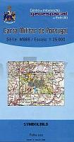
 | 460 - Topographische Landkarte Portugal 1:25.000 Carta Militar de Portugal - Série M888 Instituto Geográfico do Exército (IGeoE) - Portugal |
 | Julische Alpen - Alpi Giulie 1:25.000 (Blatt 064) *** SCHNÃPPCHEN *** 3in1 Wanderkarte 1:25000 mit Aktiv Guide inklusive Karte zur offline Verwendung in der KOMPASS-App. Fahrradfahren. Skitouren. Langlaufen. - von KOMPASS-Karten GmbH |
 | BG39 Topographische Landkarte Neuseeland 1:50.000 Land Information New Zealand |
 | 2216-II-Sà Topographische Karte Dänemark 1:25.000 Topografisk kort Danmark (DTK/Kort25) 2216-II-Sà ProjektNord - Kort & Matrikelstyrelsen / Geodætisk Institut |
 | 0348-4 MURIEL DE LA FUENTE Topographische Landkarte 1:25.000 Spanien (Grundlage MTN25) Instituto Geográfico Nacional - CNIG Spanien - ProjektNord |
 | Mönchengladbach Süd Topographische Wanderkarte Nordrhein-Westfalen mit Wanderwegen und Radwegen 1:25.000 - ProjektNord |
 | U432 Kierinki Topographische Karte 1:50.000 EUREF-FIN (Maastokarttat) Maanmittauslaitos / Lantmäteriverket Finnland - ProjektNord |
 | L2924 Schneverdingen (geplottete Ausgabe) Topographische Karte 1:50.000 Kartografie Landesvermessungsamt Niedersachsen - ProjektNord |
 | L2512 Jever (geplottete Ausgabe) Topographische Karte 1:50.000 Kartografie Landesvermessungsamt Niedersachsen - ProjektNord |
 | 3643 Werder (Havel) Sonderausgabe mit Wanderwegen - Topographische Wanderkarte Brandenburg 1:25.000 ProjektNord |
 | Usedom Kartenset 3 Rad- und Wanderkarten 1:30.000 (Zinnowitz - Ãckeritz - Peenemünde, Heringsdorf - Ahlbeck - Bansin, Lieper Winkel und Usedom) - Grünes Herz |
 | 5204 (NL 33-03-04) Nickelsdorf Topographische Wanderkarte 1:50.000 mit Wegmarkierungen - Ãsterreich - Kartographie BEV - ProjektNord |
| Irkutsker Oblast - Geographische Landkarte 1:1 Mio. / 1:1.2 Mio. Irkutskaja Oblastj - Karta obshchegeograficheskaja VostSib AGP - Russland |
 | 5104 Düren (geplottete Ausgabe) Amtliche topographische Karte 1:25.000 Landesvermessungsamt Nordrhein-Westfalen |
 | 574 Gious (Alcoutim) - Topographische Landkarte Portugal 1:25.000 Carta Militar de Portugal - Série M888 Instituto Geográfico do Exército (IGeoE) - Portugal |
 | DUMONT Reise-Taschenbuch Kalabrien *** SCHNÃPPCHEN *** von Witten, Ilona |
 | 2315-III Hadsten - mit Wanderwegen und Fahrradrouten Topographische Fahrradkarte und Wanderkarte Dänemark 1:50.000 - Kort & Matrikelstyrelsen ProjektNord 2315-III Hadsten - Topografisk Cykel- og Vandrekort Danmark |
 | U521 Tanhua Topographische Karte 1:50.000 EUREF-FIN (Maastokarttat) Maanmittauslaitos / Lantmäteriverket Finnland - ProjektNord |
| 4445-SO Topographische Karte 1:10.000 - Landesvermessungsamt Brandenburg |
 | USA - Der Osten, Mittlerer Westen, Südstaaten Nelles-Reiseführer Nelles-Verlag |