
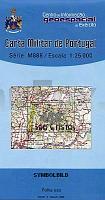
| << Portugal: Amtliche topografische Landkarten des Instituto Geográfico do Exército (IGeoE) 1:25.000 (Serie M888) |
||
|
||


Zuletzt angesehene Artikel:
 | 458 - Topographische Landkarte Portugal 1:25.000 Carta Militar de Portugal - Série M888 Instituto Geográfico do Exército (IGeoE) - Portugal |
 | Valle Vigezzo (Blatt 119) 1:25.000 - Wanderkarte - Topographische Wanderkarte (dt./engl./ital.) Valle Vigezzo - Carta Escursionistica 119 Geo4 Map - Italien |
 | 0195 MANSILLA DE LAS MULAS Topographische Landkarte 1:50.000 Spanien (Grundlage MTN50) Instituto Geográfico Nacional - CNIG Spanien - ProjektNord |
 | 0188-3 NOGUEIRA DE RAMUÍN Topographische Landkarte 1:25.000 Spanien (Grundlage MTN25) Instituto Geográfico Nacional - CNIG Spanien - ProjektNord |
 | 43A DIRKSLAND Topographische Karte der Niederlande 1:25.000 (Plotausgabe) 43A DIRKSLAND Topografische Kaart van Nederland Kadaster - ProjektNord |
 | W5131 Nellim Topographische Karte 1:25.000 EUREF (Peruskartta) Maanmittauslaitos / Lantmäteriverket Finnland - ProjektNord |
 | 1040-1 ZAFARRAYA Topographische Landkarte 1:25.000 Spanien (Grundlage MTN25) Instituto Geográfico Nacional - CNIG Spanien - ProjektNord |
 | 2313-II-SØ Topographische Karte Dänemark 1:25.000 Topografisk kort Danmark (DTK/Kort25) 2313-II-SØ ProjektNord - Kort & Matrikelstyrelsen / Geodætisk Institut |
 | 32 Bad Wurzach - Ochsenhausen 1:35.000 Topographische Wanderkarte Landesvermessungsamt Baden-Württemberg - Schwäbischer Albverein |
 | Storzic und Koschuta 1:25.000 - Bergwanderkarte Slowenien (Blatt 7) Storzic in Kosuta Planinska Zveza Slovenije |
 | M4124 Pälkäne Topographische Karte 1:25.000 EUREF (Peruskartta) Maanmittauslaitos / Lantmäteriverket Finnland - ProjektNord |
 | 0658 MORA Topographische Landkarte 1:50.000 Spanien (Grundlage MTN50) Instituto Geográfico Nacional - CNIG Spanien - ProjektNord |
 | 0245-1 ALERA Topographische Landkarte 1:25.000 Spanien (Grundlage MTN25) Instituto Geográfico Nacional - CNIG Spanien - ProjektNord |
 | N3233 Kristinestad Topographische Karte 1:25.000 EUREF (Peruskartta) Maanmittauslaitos / Lantmäteriverket Finnland - ProjektNord |
 | P5211 Maaninka Topographische Karte 1:25.000 EUREF (Peruskartta) Maanmittauslaitos / Lantmäteriverket Finnland - ProjektNord |