| << Portugal: Amtliche topografische Landkarten des Instituto Geográfico do Exército (IGeoE) 1:25.000 (Serie M888) |
||
|
||

Zuletzt angesehene Artikel:
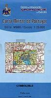
 | 455 - Topographische Landkarte Portugal 1:25.000 Carta Militar de Portugal - Série M888 Instituto Geográfico do Exército (IGeoE) - Portugal |
 | 1173 Wittenberg i. Pommern Topographische Karte 1:25.000 Messtischblatt des Deutschen Reiches - PreuÃische Landesaufnahme / Reichsamt für Landesaufnahme - Faksimile ProjektNord |
| 521.12 Amtliche topographische Karte 1:25.000 Polen |
 | 807-2 CHILLÃN Amtliche topographische Landkarte 1:25.000 Spanien (M.T.N.) 807-2 Mapa Topográfico Nacional de Espana (MTN25) Instituto Geográfico Nacional - CNIG Spanien |
 | Q4212 Ohtakari Topographische Karte 1:25.000 EUREF (Peruskartta) Maanmittauslaitos / Lantmäteriverket Finnland - ProjektNord |
 | 3449 Strausberg Sonderausgabe mit Wanderwegen - Topographische Wanderkarte Brandenburg 1:25.000 ProjektNord |
 | Zakopane 1:12.000 Stadtplan Polen Zakopane Wydawnictwo Pietka - Polen |
 | Wilhelmshaven - Wesermarsch 1:75.000 (Blatt RK-NDS04) bikeline-Radkarte Deutschland Esterbauer |
 | L2952 Schwedt/Oder-Gatow Topographische Karte 1:50.000 (Regelblattschnitt) Landesvermessungsamt Brandenburg |
 | 3341 Nennhausen Sonderausgabe mit Wanderwegen - Topographische Wanderkarte Brandenburg 1:25.000 ProjektNord |
 | Egmont (Blatt 273-09) 1:50.000 Wanderkarte - Parkmap Craig Potton - Neuseeland |
 | Flat Tops NE (Blatt: 122) Landkarte Trails Illustrated Map National Geographic - USA |
 | Osona (Blatt 24) 1:50.000 Wanderkarte Spanien - ICC - Institut Cartogrà fic de Catalunya |
 | 3036 Wittenberge Sonderausgabe mit Wanderwegen - Topographische Wanderkarte Brandenburg 1:25.000 ProjektNord |
 | 25W AMSTERDAM (Oost) Topographische Karte der Niederlande 1:50.000 Topografische Dienst (Plotausgabe) |
 | Iran StraÃatlas 1:1 Mio. (Nr. 1647) Iran Road Atlas (persian) Gitashenasi - Iran |
 | U4432 Topographische Karte 1:25.000 EUREF (Peruskartta) Maanmittauslaitos / Lantmäteriverket Finnland - ProjektNord |
 | Wandern rund um Siljan Vandra kring Siljan Calazo Förlag Schweden |
 | Rund um Hamm Topographische Wanderkarte Nordrhein-Westfalen mit Wanderwegen und Radwegen 1:25.000 - ProjektNord |
 | L2914 Oldenburg (Oldenburg) (geplottete Ausgabe) Topographische Karte 1:50.000 Kartografie Landesvermessungsamt Niedersachsen - ProjektNord |