| << Portugal: Amtliche topografische Landkarten des Instituto Geográfico do Exército (IGeoE) 1:25.000 (Serie M888) |
  | |
|
||
Zuletzt angesehene Artikel:
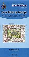
![]() | 433 - Topographische Landkarte Portugal 1:25.000 Carta Militar de Portugal - Série M888 Instituto Geográfico do Exército (IGeoE) - Portugal |
![]() | 133 - Valadares (Vila Nova de Gaia)- Topographische Landkarte Portugal 1:25.000 Carta Militar de Portugal - Série M888 Instituto Geográfico do Exército (IGeoE) - Portugal |
![]() | 3322 08 Venetpalo Topographische Karte 1:20.000 (Maastokartta / Peruskartta / Grundkarta) Maanmittauslaitos / Lantmäteriverket Finnland - ProjektNord |
![]() | 3141 07 Suomenniemi Topographische Karte 1:20.000 (Maastokartta / Peruskartta / Grundkarta) Maanmittauslaitos / Lantmäteriverket Finnland - ProjektNord |
![]() | 590-4 LA PUEBLA DE VALVERDE Amtliche topographische Landkarte 1:25.000 Spanien (M.T.N.) 590-4 Mapa Topográfico Nacional de Espana (MTN25) Instituto Geográfico Nacional - CNIG Spanien |
![]() | 3122 05 Kammiovuori Topographische Karte 1:20.000 (Maastokartta / Peruskartta / Grundkarta) Maanmittauslaitos / Lantmäteriverket Finnland - ProjektNord |
![]() | Administrative Wandkarte Polen 1:500.000 (1,50 x 1,40 m) laminiert + CD mit Straßen u. Bahnlinien Rzeczpospolita Polska Glówny Geodata Kraju |
![]() | 3814 05 Menesjärvi Topographische Karte 1:20.000 (Maastokartta / Peruskartta / Grundkarta) Maanmittauslaitos / Lantmäteriverket Finnland - ProjektNord |
![]() | 2342 03 Eskola Topographische Karte 1:20.000 (Maastokartta / Peruskartta / Grundkarta) Maanmittauslaitos / Lantmäteriverket Finnland - ProjektNord |
![]() | 6336 Vilseck Topographische Landkarte Bayern 1:25.000 - Normalausgabe - ProjektNord (geplottete Ausgabe) - Grundlage amtliche Topographische Karte Bayern DTK25 |
![]() | 44 Ortelsburg - Neidenburg - Karte des Deutschen Reiches 1:100.000 (KDR 100 GB) - Großblatt Reichsamt für Landesaufnahme / Preußische Landesaufnahme ProjektNord |
![]() | 3344 01 Kiltuanjärvi Topographische Karte 1:20.000 (Maastokartta / Peruskartta / Grundkarta) Maanmittauslaitos / Lantmäteriverket Finnland - ProjektNord |
![]() | 704 (11-28) Cáceres Amtliche topographische Landkarte 1:50.000 Spanien (M.T.N.) 704 Mapa Topográfico Nacional de Espana (MTN50) Instituto Geográfico Nacional - CNIG Spanien |
![]() | Ayvalik - Pergamon - Topographische Reisekarte 1:250.000 Türkei (Blatt 4) *** SCHNÄPPCHEN *** mit Wanderwegen und Radwanderwegen - Landkarte ProjektNord |
![]() | 8327 Buchenberg Topographische Landkarte Bayern 1:25.000 - Normalausgabe - ProjektNord (geplottete Ausgabe) - Grundlage amtliche Topographische Karte Bayern DTK25 |


