| << Portugal: Amtliche topografische Landkarten des Instituto Geográfico do Exército (IGeoE) 1:25.000 (Serie M888) |
||
|
||

Zuletzt angesehene Artikel:
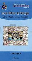
 | 430 Oeiras - Topographische Landkarte Portugal 1:25.000 Carta Militar de Portugal - Série M888 Instituto Geográfico do Exército (IGeoE) - Portugal |
 | 5314 Rennerod - Wanderkarte mit Wanderwegen (geplottete Ausgabe) ProjektNord - Grundlage Amtliche topographische Karte Landesamt für Vermessung und Geobasisinformation Rheinland-Pfalz |
 | 847 Villajoyosa / La Vila Joiosa Amtliche topographische Landkarte 1:50.000 Spanien (M.T.N.) 847 Mapa Topográfico Nacional de Espana (MTN50) Instituto Geográfico Nacional - CNIG Spanien |
 | CC 3910 Bielefeld Bodenübersichtskarte 1:200.000 - Bundesanstalt für Geowissenschaften und Rohstoffe (BGR) |
 | 0200-4 BURGOS ESTE Topographische Landkarte 1:25.000 Spanien (Grundlage MTN25) Instituto Geográfico Nacional - CNIG Spanien - ProjektNord |
 | 5509 Burgbrohl - Wanderkarte mit Wanderwegen (geplottete Ausgabe) ProjektNord - Grundlage Amtliche topographische Karte Landesamt für Vermessung und Geobasisinformation Rheinland-Pfalz |
 | 315 - Topographische Landkarte Portugal 1:25.000 Carta Militar de Portugal - Série M888 Instituto Geográfico do Exército (IGeoE) - Portugal |
 | NL 33-01-24 (3224) Schladming Ãsterreichische Karte 1:50.000 mit Wegmarkierungen (topographische Wanderkarte - UTM) - BEV - Ãsterreich |
 | 0457-2 TURÃGANO Topographische Landkarte 1:25.000 Spanien (Grundlage MTN25) Instituto Geográfico Nacional - CNIG Spanien - ProjektNord |
| Erläuterungen zur Geologischen Karte 5242 Stollberg (Erzgebirge) - Ausgabe 2014 Sächsisches Landesamt für Umwelt, Landwirtschaft und Geologie |
 | Provinz Genua (Blatt GE-20) Topographische StraÃenkarte und Touristenkarte 1:100.000 mit Radwegen Provincia di Genova - Carta stradale e turistica con piste ciclabili EdM Edizioni del Magistero - Italien |
 | 6208 Morscheid-Riedenburg - Wanderkarte mit Wanderwegen (geplottete Ausgabe) ProjektNord - Grundlage Amtliche topographische Karte Landesamt für Vermessung und Geobasisinformation Rheinland-Pfalz |
 | 0721-4 MONSERRAT Topographische Landkarte 1:25.000 Spanien (Grundlage MTN25) Instituto Geográfico Nacional - CNIG Spanien - ProjektNord |
 | 0741 MINAYA Topographische Landkarte 1:50.000 Spanien (Grundlage MTN50) Instituto Geográfico Nacional - CNIG Spanien - ProjektNord |
 | 396 Topographische Landkarte Wanderkarte und Fahrradkarte Portugal 1:25.000 396 Mapa topográfico - Mapa de caminhadas - Portugal 1:25.000 ProjektNord |
 | 0408-3 MONTEAGUDO DE LAS VICARÃAS Topographische Landkarte 1:25.000 Spanien (Grundlage MTN25) Instituto Geográfico Nacional - CNIG Spanien - ProjektNord |
 | CC 3102 Emden Geologische Ãbersichtskarte 1:200.000 - Bundesanstalt für Geowissenschaften und Rohstoffe (BGR) |
 | 0056-4 TAMA Topographische Landkarte 1:25.000 Spanien (Grundlage MTN25) Instituto Geográfico Nacional - CNIG Spanien - ProjektNord |
 | 0780 PUEBLA DE ALCOCER Topographische Landkarte 1:50.000 Spanien (Grundlage MTN50) Instituto Geográfico Nacional - CNIG Spanien - ProjektNord |
 | 83 (18-06) Reinosa Amtliche topographische Landkarte 1:50.000 Spanien (M.T.N.) 83 Mapa Topográfico Nacional de Espana (MTN50) Instituto Geográfico Nacional - CNIG Spanien |