| << Portugal: Amtliche topografische Landkarten des Instituto Geográfico do Exército (IGeoE) 1:25.000 (Serie M888) |
||
|
||

Zuletzt angesehene Artikel:
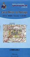
 | 389 - Topographische Landkarte Portugal 1:25.000 Carta Militar de Portugal - Série M888 Instituto Geográfico do Exército (IGeoE) - Portugal |
 | Südtirol, Trentino, Gardasee, Venetien - Sud Tirol, Trentin, Lac de Garde, Venetie 1:200.000 Auto- + Freizeitkarte Alto Adige, Trentino, Lago di Garda, Veneto - Tirol del Sur, Trentino, Lago del Garda freytag & berndt |
 | 234-3 MELGAR DE ABAJO Amtliche topographische Landkarte 1:25.000 Spanien (M.T.N.) 234-3 Mapa Topográfico Nacional de Espana (MTN25) Instituto Geográfico Nacional - CNIG Spanien |
 | 829-4 VILLAFRANCA DE LOS BARRO Amtliche topographische Landkarte 1:25.000 Spanien (M.T.N.) 829-4 Mapa Topográfico Nacional de Espana (MTN25) Instituto Geográfico Nacional - CNIG Spanien |
 | Sankt Petersburg und Leningrader Gebiet - Sankt Petersburg 1:40.000 - Leningrader Gebiet 1:470.000 Sankt-Peterburg, Leningradskaja oblast - Karta dlja woditelej Karta LTD Sankt Petersburg |
 | GreenVelo: GroÃpolen - Posen und Umgebung (Westteil) 1:100.000 Radwanderkarte der Radwege - Steinpapier Wielkopolska, Poznań i okolice część zachodnia GreenVelo mapa tras rowerowych (papier skalny) Europilot - Daunpol - Polen |
 | 3724 01 Kuontalonpalo Topographische Karte 1:20.000 (Maastokartta / Peruskartta / Grundkarta) Maanmittauslaitos / Lantmäteriverket Finnland - ProjektNord |
 | GreenVelo: Niederschlesien - Breslau (Westteil) 1:100.000 Radwanderkarte der Radwege - Steinpapier Dolny Śląsk, Wrocław i okolice część zachodnia GreenVelo mapa tras rowerowych (papier skalny) Europilot - Daunpol - Polen |
 | 576-4 LAGUNA DEL BARCO Amtliche topographische Landkarte 1:25.000 Spanien (M.T.N.) 576-4 Mapa Topográfico Nacional de Espana (MTN25) Instituto Geográfico Nacional - CNIG Spanien |
 | 358-3 BELVER DE CINCA Amtliche topographische Landkarte 1:25.000 Spanien (M.T.N.) 358-3 Mapa Topográfico Nacional de Espana (MTN25) Instituto Geográfico Nacional - CNIG Spanien |
 | 3710 Rheine (geplottete Ausgabe) *** SCHNÃPPCHEN *** Amtliche topographische Karte 1:25.000 Landesvermessungsamt Nordrhein-Westfalen |
 | 124 - Topographische Landkarte Portugal 1:25.000 Carta Militar de Portugal - Série M888 Instituto Geográfico do Exército (IGeoE) - Portugal |
 | 485 - Topographische Landkarte Portugal 1:25.000 Carta Militar de Portugal - Série M888 Instituto Geográfico do Exército (IGeoE) - Portugal |
 | Pyrénées Orientales à pied - Réf. D066 Topographischer Wanderführer - FFRP (Fédération française de randonnée pédestre) Frankreich |
 | Polnische Ostseeküste: Horst - Henkenhagen - Wanderkarte 1:50.000 WYBRZEŻE BAŁTYKU - Niechorze - Ustronie Morskie Cartomedia - Rokart Polen |
 | 13 Camacha - Ilha de Porto Santo (Madeira) - Topografische Karte Portugal 1:25.000 Carta Militar de Portugal - Série P821 - 1/25 000 (Madeira) - Instituto Geográfico do Exército (IGeoE) - Portugal |
 | Siauliai - Mazeikiei - Region (Nordwest-Litauen) Touristische Landkarte 1:130.000 Šiaures Žemaitija (Šiauliai, Mažeikiai regions) - Briedis - Litauen |
 | 463 - Topographische Landkarte Portugal 1:25.000 Carta Militar de Portugal - Série M888 Instituto Geográfico do Exército (IGeoE) - Portugal |
 | 284-3 CASTILLO DE SORA Amtliche topographische Landkarte 1:25.000 Spanien (M.T.N.) 284-3 Mapa Topográfico Nacional de Espana (MTN25) Instituto Geográfico Nacional - CNIG Spanien |
 | Trebnitz - Obernigk Stadtplan 1:10.000 mit Führer - Katzengebirge 1:40.000 und 1:60.000 (polnisch) Wanderkarte, Landkarte, Radwanderkarte (Spiralo) Trzebnica Oborniki Śląskie przewodnik PLAN Galileos - Polen |