| << Portugal: Amtliche topografische Landkarten des Instituto Geográfico do Exército (IGeoE) 1:25.000 (Serie M888) |
||
|
||

Zuletzt angesehene Artikel:
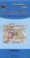
 | 373 - Topographische Landkarte Portugal 1:25.000 Carta Militar de Portugal - Série M888 Instituto Geográfico do Exército (IGeoE) - Portugal |
 | 531-3 RIOFRÃO Amtliche topographische Landkarte 1:25.000 Spanien (M.T.N.) 531-3 Mapa Topográfico Nacional de Espana (MTN25) Instituto Geográfico Nacional - CNIG Spanien |
 | 844-2 SIERRA LOS GAVILANES Amtliche topographische Landkarte 1:25.000 Spanien (M.T.N.) 844-2 Mapa Topográfico Nacional de Espana (MTN25) Instituto Geográfico Nacional - CNIG Spanien |
 | Volcanisme du Cantal - Auvergne Wanderführer - Mountainbikeführer (französisch) Volcanisme du Cantal - Auvergne - Découverte du patrimoine - glossaire illustré, atlas, adresses Chamina - Frankreich |
 | 49C KRABBENDIJKE Topographische Karte der Niederlande 1:25.000 (Plotausgabe) 49C KRABBENDIJKE Topografische Kaart van Nederland Kadaster - ProjektNord |
 | 0550-3 LA ALBERGUERÃA DE ARGAÃÃN Topographische Landkarte 1:25.000 Spanien (Grundlage MTN25) Instituto Geográfico Nacional - CNIG Spanien - ProjektNord |
 | Umgebung der Golub Kaszubski - Wander- und Fahrradwege Wanderkarte und Fahrradkarte Szlaki spacerowe i rowerowe wokół Gołubia Kaszubskiego CartoMedia - Polen |
 | 306-1 MANZANAL DE ARRIBA Amtliche topographische Landkarte 1:25.000 Spanien (M.T.N.) 306-1 Mapa Topográfico Nacional de Espana (MTN25) Instituto Geográfico Nacional - CNIG Spanien |
 | 23 Vinhais Topographische Landkarte Wanderkarte und Fahrradkarte Portugal 1:25.000 023 Mapa topográfico - Mapa de caminhadas - Portugal 1:25.000 ProjektNord |
 | 420-4/421-3 Barcelona Amtliche topographische Landkarte 1:25.000 Spanien (M.T.N.) 420-4/421-3 Mapa Topográfico Nacional de Espana (MTN25) Instituto Geográfico Nacional - CNIG Spanien |
 | 33-3 S. VICENTE DE LA BARQUERA Amtliche topographische Landkarte 1:25.000 Spanien (M.T.N.) 33-3 Mapa Topográfico Nacional de Espana (MTN25) Instituto Geográfico Nacional - CNIG Spanien |
 | 4221 09 Viuruniemi Topographische Karte 1:20.000 (Maastokartta / Peruskartta / Grundkarta) Maanmittauslaitos / Lantmäteriverket Finnland - ProjektNord |
 | 1042-4 Torvizcón Amtliche topographische Landkarte 1:25.000 Spanien (M.T.N.) 1042-4 Mapa Topográfico Nacional de Espana (MTN25) Instituto Geográfico Nacional - CNIG Spanien |
 | Naturpark Marismas del Odiel - Topographische Wanderkarte 1:25.000 *** SCHNÃPPCHEN *** Paraje Natural Marismas del Odiel CNIG Spanien |
 | 5640 Klingenthal-Zwota (152) - Geologische Karte 1:25.000 (GK25) Grundlage Messtischblatttopographie Sächsisches Landesamt für Umwelt, Landwirtschaft und Geologie |
 | 246 Fundao - Topographische Landkarte Portugal 1:25.000 Carta Militar de Portugal - Série M888 Instituto Geográfico do Exército (IGeoE) - Portugal |
 | 972-3 ZÃJAR Amtliche topographische Landkarte 1:25.000 Spanien (M.T.N.) 972-3 Mapa Topográfico Nacional de Espana (MTN25) Instituto Geográfico Nacional - CNIG Spanien |
 | 994 (22-40) Baza Amtliche topographische Landkarte 1:50.000 Spanien (M.T.N.) 994 Mapa Topográfico Nacional de Espana (MTN50) Instituto Geográfico Nacional - CNIG Spanien |
 | 830-1 PUEBLA DE LA REINA Amtliche topographische Landkarte 1:25.000 Spanien (M.T.N.) 830-1 Mapa Topográfico Nacional de Espana (MTN25) Instituto Geográfico Nacional - CNIG Spanien |
 | 283 - Topographische Landkarte Portugal 1:25.000 Carta Militar de Portugal - Série M888 Instituto Geográfico do Exército (IGeoE) - Portugal |