| << Portugal: Amtliche topografische Landkarten des Instituto Geográfico do Exército (IGeoE) 1:25.000 (Serie M888) |
||
|
||

Zuletzt angesehene Artikel:
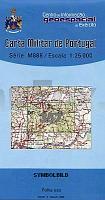
 | 357 - Topographische Landkarte Portugal 1:25.000 Carta Militar de Portugal - Série M888 Instituto Geográfico do Exército (IGeoE) - Portugal |
 | NL 33-04-04 West (3104-West) Stall - AuÃerfragant - Flattach - Kreuzeckgruppe - Mölltal Ãsterreichische Karte 1:25.000 mit Wegmarkierungen (topographische Wanderkarte - UTM) - BEV - Ãsterreich - VergröÃerung (ÃK25V) |
 | 3531 02 Ruottisenharju Topographische Karte 1:20.000 (Maastokartta / Peruskartta / Grundkarta) Maanmittauslaitos / Lantmäteriverket Finnland - ProjektNord |
 | 810 Puertollano Amtliche topographische Landkarte 1:50.000 Spanien (M.T.N.) 810 Mapa Topográfico Nacional de Espana (MTN50) Instituto Geográfico Nacional - CNIG Spanien |
 | Wojewodschaft Oppeln 1:190.000 / Stadtplan Oppeln 1:22.500 mit den neuen administrativen Grenzen Touristenkarte Polen Województwo opolskie, Opole w nowych granicach administracyjnych- mapa papierowa PLAN Galileos - Polen |
 | 3823 09 Littemuoroaivi Topographische Karte 1:20.000 (Maastokartta / Peruskartta / Grundkarta) Maanmittauslaitos / Lantmäteriverket Finnland - ProjektNord |
 | 0867-1 ELCHE DE LA SIERRA Topographische Landkarte 1:25.000 Spanien (Grundlage MTN25) Instituto Geográfico Nacional - CNIG Spanien - ProjektNord |
 | Mountainbiken in den Dolomiten - 52 Ringtouren in Primiero, S. Martino di Castrozza, Cortina d`Ampezzo, Val Boite, Agordino, Val Fiorentina, Zoldotal, Longarone, Cadore, Comelico, Valli Gardena und Pusteria e Fassa - von Enrico Raccanelli, Luca De Antoni - Mountainbikeführer - Italien - Versante Sud |
 | 647-3 / 673-1 Maó-Mahón (Menorca) Amtliche topographische Landkarte 1:25.000 Spanien (M.T.N.) 647-3 / 673-1 Mapa Topográfico Nacional de Espana (MTN25) Instituto Geográfico Nacional - CNIG Spanien |
 | 291-3 PERAMOLA Amtliche topographische Landkarte 1:25.000 Spanien (M.T.N.) 291-3 Mapa Topográfico Nacional de Espana (MTN25) Instituto Geográfico Nacional - CNIG Spanien |
 | 562 Santa Clara-A-Velha (Odemira) Topographische Landkarte Portugal 1:25.000 Carta Militar de Portugal - Série M888 Instituto Geográfico do Exército (IGeoE) - Portugal |
 | Erläuterungen zur Geologischen Karte 5247 Nassau (118) - Ausgabe 1886 Sächsisches Landesamt für Umwelt, Landwirtschaft und Geologie |
| 5539 Oelsnitz-Bergen (143) - Geologische Karte 1:25.000 (GK25) Grundlage Messtischblatttopographie Sächsisches Landesamt für Umwelt, Landwirtschaft und Geologie |
 | Mit dem Wohnmobil nach Ãsterreich (Band 60) Der Westen. Oberösterreich, Salzburg, Steiermark, Kärnten, Tirol, Vorarlberg. Die Anleitung für einen Erlebnisurlaub. Tipps, Tricks, Touren, Tolle Plätze. Alle Plätze mit präzisen GPS-Daten - von Rainer Klee - Womo |
 | 6428 Bad Windsheim Topographische Landkarte Bayern 1:25.000 - Normalausgabe - ProjektNord (geplottete Ausgabe) - Grundlage amtliche Topographische Karte Bayern DTK25 |
| 367-1 URRETONAS Amtliche topographische Landkarte 1:25.000 Spanien (M.T.N.) 367-1 Mapa Topográfico Nacional de Espana (MTN25) Instituto Geográfico Nacional - CNIG Spanien |
 | 11 S. Mateus (Pico - Azoren) - Topographische Karte Portugal 1:25.000 Carta Militar de Portugal - Série M889 - 1/25 000 (Acores) - Instituto Geográfico do Exército (IGeoE) - Portugal |
 | 7334 Reichertshofen Topographische Landkarte Bayern 1:25.000 - Normalausgabe - ProjektNord (geplottete Ausgabe) - Grundlage amtliche Topographische Karte Bayern DTK25 |
 | 3831 06 Auskottivaara Topographische Karte 1:20.000 (Maastokartta / Peruskartta / Grundkarta) Maanmittauslaitos / Lantmäteriverket Finnland - ProjektNord |
 | Hansestadt Greifswald und Umgebung - Radwander- und Wanderkarte 1:50.000 (Nr. 179) Ausflüge zwischen Peenemünde, Wolgast, Seebad Lubmin, Sassen-Trantow, Meskenhagen und Sundholz. Radwander- und Wanderkarte. Mit Stadtplan Greifswald. 1:20.000, GPS-fähig. Wettefest, reiÃfest Dr. Barthel Verlag |