
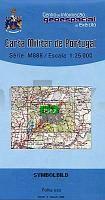
| << Portugal: Amtliche topografische Landkarten des Instituto Geográfico do Exército (IGeoE) 1:25.000 (Serie M888) |
||
|
||


Zuletzt angesehene Artikel:
 | 303 - Topographische Landkarte Portugal 1:25.000 Carta Militar de Portugal - Série M888 Instituto Geográfico do Exército (IGeoE) - Portugal |
 | 52-4 LA VEGA Amtliche topographische Landkarte 1:25.000 Spanien (M.T.N.) 52-4 Mapa Topográfico Nacional de Espana (MTN25) Instituto Geográfico Nacional - CNIG Spanien |
 | 0555-3 NAVARREDONDA DE GREDOS Topographische Landkarte 1:25.000 Spanien (Grundlage MTN25) Instituto Geográfico Nacional - CNIG Spanien - ProjektNord |
 | 0662-2 VILLAVERDE Y PASACONSOL Topographische Landkarte 1:25.000 Spanien (Grundlage MTN25) Instituto Geográfico Nacional - CNIG Spanien - ProjektNord |
 | Shorong-Hinku (Blatt 5) 1:50.000 Trekkingkarte - Kartenwerk der Arbeitsgemeinschaft für vergleichende Hochgebirgsforschung - Nepal Technische Universität Dresden |
 | 49-1 SANTA EULALIA DE OSCOS Amtliche topographische Landkarte 1:25.000 Spanien (M.T.N.) 49-1 Mapa Topográfico Nacional de Espana (MTN25) Instituto Geográfico Nacional - CNIG Spanien |
 | 5162 Ruhbank Topographische Karte 1:25.000 Messtischblatt des Deutschen Reiches - Preußische Landesaufnahme / Reichsamt für Landesaufnahme - Faksimile ProjektNord |
 | 6-3 Cabeceiras de Basto - Topographische Landkarte Portugal 1:50.000 Carta Militar de Portugal Instituto Geográfico do Exército (IGeoE) - Portugal |
 | Lake District West - Wanderkarte 1:40.000 (wasser- und reißfest) Ultramap XT40 Lake District west - hiking map (durable, tear-resistent and 100% waterproof) HARVEY MAPS - Großbritannien |