| << Portugal: Amtliche topografische Landkarten des Instituto Geográfico do Exército (IGeoE) 1:25.000 (Serie M888) |
||
|
||

Zuletzt angesehene Artikel:
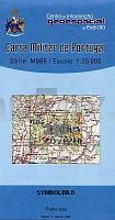
 | 299 - Topographische Landkarte Portugal 1:25.000 Carta Militar de Portugal - Série M888 Instituto Geográfico do Exército (IGeoE) - Portugal |
 | 3321 06+03 Väätinperä Topographische Karte 1:20.000 (Maastokartta / Peruskartta / Grundkarta) Maanmittauslaitos / Lantmäteriverket Finnland - ProjektNord |
 | 1045-3 ALMERÃA Topographische Landkarte 1:25.000 Spanien (Grundlage MTN25) Instituto Geográfico Nacional - CNIG Spanien - ProjektNord |
 | 2723 04 KANGOSJÃRVI Topographische Karte 1:20.000 (Maastokartta / Peruskartta / Grundkarta) Maanmittauslaitos / Lantmäteriverket Finnland - ProjektNord |
 | 719-2 LOS ISIDROS Amtliche topographische Landkarte 1:25.000 Spanien (M.T.N.) 719-2 Mapa Topográfico Nacional de Espana (MTN25) Instituto Geográfico Nacional - CNIG Spanien |
 | 3941 01 UTSJOKI Topographische Karte 1:20.000 (Maastokartta / Peruskartta / Grundkarta) Maanmittauslaitos / Lantmäteriverket Finnland - ProjektNord |
 | 54-4 CAMPO DE CASO Amtliche topographische Landkarte 1:25.000 Spanien (M.T.N.) 54-4 Mapa Topográfico Nacional de Espana (MTN25) Instituto Geográfico Nacional - CNIG Spanien |
 | 0661 VILLAREJO DE FUENTES Topographische Landkarte 1:50.000 Spanien (Grundlage MTN50) Instituto Geográfico Nacional - CNIG Spanien - ProjektNord |
 | 712-3 Urda Amtliche topographische Landkarte 1:25.000 Spanien (M.T.N.) 712-3 Mapa Topográfico Nacional de Espana (MTN25) Instituto Geográfico Nacional - CNIG Spanien |
 | 3841 08 Viimassaari Topographische Karte 1:20.000 (Maastokartta / Peruskartta / Grundkarta) Maanmittauslaitos / Lantmäteriverket Finnland - ProjektNord |
 | Pyalma - Kischi (Nördlicher Onegasee - Karelien) 1:100.000 Topographische Landkarte Russland Pjalma - Kizhi - (Respublika Karelia) - Karta - Aerogeodezija Aerogeodezia Russland |
 | 174-1 AIBAR/OIBAR Amtliche topographische Landkarte 1:25.000 Spanien (M.T.N.) 174-1 Mapa Topográfico Nacional de Espana (MTN25) Instituto Geográfico Nacional - CNIG Spanien |
 | 1043 10 Pargas Topographische Karte 1:20.000 (Maastokartta / Peruskartta / Grundkarta) Maanmittauslaitos / Lantmäteriverket Finnland - ProjektNord |
 | 991-2 CAMPOTÃJAR Amtliche topographische Landkarte 1:25.000 Spanien (M.T.N.) 991-2 Mapa Topográfico Nacional de Espana (MTN25) Instituto Geográfico Nacional - CNIG Spanien |
 | 508-4 MORALZARZAL Amtliche topographische Landkarte 1:25.000 Spanien (M.T.N.) 508-4 Mapa Topográfico Nacional de Espana (MTN25) Instituto Geográfico Nacional - CNIG Spanien |
 | 612-2 CASTIELFABIB Amtliche topographische Landkarte 1:25.000 Spanien (M.T.N.) 612-2 Mapa Topográfico Nacional de Espana (MTN25) Instituto Geográfico Nacional - CNIG Spanien |
 | 5 Fünen - Fahrradkarte Dänemark 1:100.000 - zweiseitig - wasserfest Fünen - Langeland - Ãrø - Alsen - Auf Basis der topographischen Karte Dänemark 5 Cykelkort Danmark - Fyn - Langeland - Ãrø - Als - vandfast ProjektNord |
 | 127-1 PÃRAMO DEL SIL Amtliche topographische Landkarte 1:25.000 Spanien (M.T.N.) 127-1 Mapa Topográfico Nacional de Espana (MTN25) Instituto Geográfico Nacional - CNIG Spanien |
 | 334-3 Cassá de la Selva Amtliche topographische Landkarte 1:25.000 Spanien (M.T.N.) 334-3 Mapa Topográfico Nacional de Espana (MTN25) Instituto Geográfico Nacional - CNIG Spanien |
| Lazdijai (50-54/20-24) Topografische Karte Litauen 1:50.000 Lietuvos Respublikos Topografinis Zemelapis 1:50.000 - Nacionaline Zemes Tarnyba - Litauen |