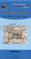
| << Portugal: Amtliche topografische Landkarten des Instituto Geográfico do Exército (IGeoE) 1:25.000 (Serie M888) |
||
|
||

Zuletzt angesehene Artikel:
 | 299 - Topographische Landkarte Portugal 1:25.000 Carta Militar de Portugal - Série M888 Instituto Geográfico do Exército (IGeoE) - Portugal |
 | Sør-Varanger - Bugøynes - Grense Jakobselv - Seekarte Norwegische Küste 1:50.000 - (Blatt 116) Den Norske Kyst Sjøkart - Hovedkart (sjø) Statens Kartverk Sjø - Norwegen |
| Erläuterungen zur Geologischen Karte 5542 Johanngeorgenstadt (146) - Ausgabe 1900 Sächsisches Landesamt für Umwelt, Landwirtschaft und Geologie |
 | 940-4 CASTILBLANCO DE LOS ARRS Amtliche topographische Landkarte 1:25.000 Spanien (M.T.N.) 940-4 Mapa Topográfico Nacional de Espana (MTN25) Instituto Geográfico Nacional - CNIG Spanien |
 | 3332 11 Varpaisjärvi Topographische Karte 1:20.000 (Maastokartta / Peruskartta / Grundkarta) Maanmittauslaitos / Lantmäteriverket Finnland - ProjektNord |
 | 710-1 RETUERTA DEL BULLAQUE Amtliche topographische Landkarte 1:25.000 Spanien (M.T.N.) 710-1 Mapa Topográfico Nacional de Espana (MTN25) Instituto Geográfico Nacional - CNIG Spanien |
 | TheiÃ-See - Freizeitkarte - Topographische Radwanderkarte und Wassersportkarte Ungarn 1:50.000 wasserfest - GPS-tauglich Tisza-tó Szabadidötérkép / leisure map - Cartographia |
 | 29 (13-04) Oviedo Amtliche topographische Landkarte 1:50.000 Spanien (M.T.N.) 29 Mapa Topográfico Nacional de Espana (MTN50) Instituto Geográfico Nacional - CNIG Spanien |
 | Alexandrow Stadtplan 1:12.500 / Region Alexandrow StraÃenkarte 1:200.000 StraÃenkarte - Russland Александров - Александровский район Rus Co. Ltd. |
 | 777-1 LA GARROVILLA Amtliche topographische Landkarte 1:25.000 Spanien (M.T.N.) 777-1 Mapa Topográfico Nacional de Espana (MTN25) Instituto Geográfico Nacional - CNIG Spanien |
 | 1086-II (Fuerteventura) Corralejo Amtliche topographische Landkarte 1:25.000 Spanien (M.T.N.) 1086-II Mapa Topográfico Nacional de Espana (MTN25) Instituto Geográfico Nacional - CNIG Spanien |
 | 366 (39-14) Sant Feliu de GuÃxols Amtliche topographische Landkarte 1:50.000 Spanien (M.T.N.) 366 Mapa Topográfico Nacional de Espana (MTN50) Instituto Geográfico Nacional - CNIG Spanien |
 | 296-2/297-1 (78-23) L`ESCALA Amtliche topographische Landkarte 1:25.000 Spanien (M.T.N.) 296-2/297-1 Mapa Topográfico Nacional de Espana (MTN25) Instituto Geográfico Nacional - CNIG Spanien |
 | 17 Lindoso (Pnte da Barca) - Topographische Landkarte Portugal 1:25.000 Carta Militar de Portugal - Série M888 Instituto Geográfico do Exército (IGeoE) - Portugal |
 | Fürstentümer Schwarzburg und Reuss 1864 - Historische Landkarte Nachdruck Planokarte - gerollt - Bearbeitet von C. Graf - Situation und Schrift von H. Szene. Terrain gezeichnet und grav. von V. Geyer - Verlag Rockstuhl |
 | 1055 (19-44) Motril Amtliche topographische Landkarte 1:50.000 Spanien (M.T.N.) 1055 Mapa Topográfico Nacional de Espana (MTN50) Instituto Geográfico Nacional - CNIG Spanien |
 | 350 Bombarral - Topographische Landkarte Portugal 1:25.000 Carta Militar de Portugal - Série M888 Instituto Geográfico do Exército (IGeoE) - Portugal |
 | 465 - Topographische Landkarte Portugal 1:25.000 Carta Militar de Portugal - Série M888 Instituto Geográfico do Exército (IGeoE) - Portugal |
 | 398-3 LA BOVEDA DE TORO Amtliche topographische Landkarte 1:25.000 Spanien (M.T.N.) 398-3 Mapa Topográfico Nacional de Espana (MTN25) Instituto Geográfico Nacional - CNIG Spanien |
 | 350-2 ALDEHUELA DE PERIÃNEZ Amtliche topographische Landkarte 1:25.000 Spanien (M.T.N.) 350-2 Mapa Topográfico Nacional de Espana (MTN25) Instituto Geográfico Nacional - CNIG Spanien |