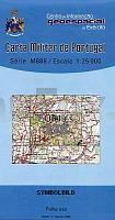
| << Portugal: Amtliche topografische Landkarten des Instituto Geográfico do Exército (IGeoE) 1:25.000 (Serie M888) |
||
|
||

Zuletzt angesehene Artikel:
 | 278 Oleiros - Topographische Landkarte Portugal 1:25.000 Carta Militar de Portugal - Série M888 Instituto Geográfico do Exército (IGeoE) - Portugal |
 | 0449-3 SAUCELLE Topographische Landkarte 1:25.000 Spanien (Grundlage MTN25) Instituto Geográfico Nacional - CNIG Spanien - ProjektNord |
 | 0406-3 CALTOJAR Topographische Landkarte 1:25.000 Spanien (Grundlage MTN25) Instituto Geográfico Nacional - CNIG Spanien - ProjektNord |
 | 3646 Blankenfelde Sonderausgabe mit Wanderwegen - Topographische Wanderkarte Brandenburg 1:25.000 ProjektNord |
 | CC 7942 Passau Bodenübersichtskarte 1:200.000 - Bundesanstalt für Geowissenschaften und Rohstoffe (BGR) |
 | 502-2 MATILLA DE LOS CAÃOS DEL RÃO Amtliche topographische Landkarte 1:25.000 Spanien (M.T.N.) 502-2 Mapa Topográfico Nacional de Espana (MTN25) Instituto Geográfico Nacional - CNIG Spanien |
 | Mathe Magie - Rechnen bis 100 PRESSOGRAM Zaubertafel Mathematik PRODESIGN Lernspiel GmbH |
 | 793 Almansa Amtliche topographische Landkarte 1:50.000 Spanien (M.T.N.) 793 Mapa Topográfico Nacional de Espana (MTN50) Instituto Geográfico Nacional - CNIG Spanien |
 | 463 Topographische Landkarte Wanderkarte und Fahrradkarte Portugal 1:25.000 463 Mapa topográfico - Mapa de caminhadas - Portugal 1:25.000 ProjektNord |
 | 0774 ILLA DE CABRERA Topographische Landkarte 1:50.000 Spanien (Grundlage MTN50) Instituto Geográfico Nacional - CNIG Spanien - ProjektNord |
 | 2212-IV-Sà Topographische Karte Dänemark 1:25.000 Topografisk kort Danmark (DTK/Kort25) 2212-IV-Sà ProjektNord - Kort & Matrikelstyrelsen / Geodætisk Institut |
 | Thailand 1:2 Mio. StraÃenkarte Thailand Travel Map Periplus Editors |
 | 129 La Robila Amtliche topographische Landkarte 1:50.000 Spanien (M.T.N.) 129 Mapa Topográfico Nacional de Espana (MTN50) Instituto Geográfico Nacional - CNIG Spanien |
 | NL 33-01-25 (3225) St. Peter in Ahrn Ãsterreichische Karte 1:50.000 mit Wegmarkierungen (topographische Wanderkarte - UTM) - BEV - Ãsterreich |
| NJ 37-10 Sanli Urfa Amtliche Topographische Karte der Türkei 1:250.000 NJ 37-10 Şanli Urfa - Müşterek Harekat Haritası HGK |
 | 0328 ARTESA DE SEGRE Topographische Landkarte 1:50.000 Spanien (Grundlage MTN50) Instituto Geográfico Nacional - CNIG Spanien - ProjektNord |
 | Island 4 Stadfraedikort 1:50.000 CD-ROM *** SCHNÃPPCHEN *** KORTADISKUR 4 - Staðfræðikort |
 | 0709 ANCHURAS Topographische Landkarte 1:50.000 Spanien (Grundlage MTN50) Instituto Geográfico Nacional - CNIG Spanien - ProjektNord |
 | 363 Aveiras de Cima (Azambuja) Topographische Landkarte Portugal 1:25.000 Carta Militar de Portugal - Série M888 Instituto Geográfico do Exército (IGeoE) - Portugal |
 | Westerwald - Bad Marienberg - Hachenburg Topographische Wanderkarte Rheinland-Pfalz mit Wanderwegen und Radwegen 1:25.000 - ProjektNord |