| << Portugal: Amtliche topografische Landkarten des Instituto Geográfico do Exército (IGeoE) 1:25.000 (Serie M888) |
||
|
||

Zuletzt angesehene Artikel:
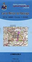
 | 271 - Topographische Landkarte Portugal 1:25.000 Carta Militar de Portugal - Série M888 Instituto Geográfico do Exército (IGeoE) - Portugal |
 | 240 Montemor-O-Velho Topographische Landkarte Wanderkarte und Fahrradkarte Portugal 1:25.000 240 Mapa topográfico - Mapa de caminhadas - Portugal 1:25.000 ProjektNord |
 | 485-1 EL ATAZAR Amtliche topographische Landkarte 1:25.000 Spanien (M.T.N.) 485-1 Mapa Topográfico Nacional de Espana (MTN25) Instituto Geográfico Nacional - CNIG Spanien |
 | 690 La Alberca de Záncara Amtliche topographische Landkarte 1:50.000 Spanien (M.T.N.) 690 Mapa Topográfico Nacional de Espana (MTN50) Instituto Geográfico Nacional - CNIG Spanien |
 | Erläuterungen zur Geologischen Karte 4751 Kloster St. Marienstern (37) - Ausgabe 1890 Sächsisches Landesamt für Umwelt, Landwirtschaft und Geologie |
 | Forti di Genova - Via del sale (Blatt GE-1) *** SCHNÃPPCHEN *** Topographische Wanderkarte 1:25.000 Carta dei Sentieri Sentieri - Forti di Genova e Golfo Paradiso EdM - Edizioni del Magistero - Italien |
 | 487 Torrao (Alcacer do Sal) Topographische Landkarte Wanderkarte und Fahrradkarte Portugal 1:25.000 487 Mapa topográfico - Mapa de caminhadas - Portugal 1:25.000 ProjektNord |
 | 1006 Benameji Amtliche topographische Landkarte 1:50.000 Spanien (M.T.N.) 1006 Mapa Topográfico Nacional de Espana (MTN50) Instituto Geográfico Nacional - CNIG Spanien |
 | 2221 05 Jalasjärvi Topographische Karte 1:20.000 (Maastokartta / Peruskartta / Grundkarta) Maanmittauslaitos / Lantmäteriverket Finnland - ProjektNord |
 | 652-1 SERREJÃN Amtliche topographische Landkarte 1:25.000 Spanien (M.T.N.) 652-1 Mapa Topográfico Nacional de Espana (MTN25) Instituto Geográfico Nacional - CNIG Spanien |
 | 149 Salardu Amtliche topographische Landkarte 1:50.000 Spanien (M.T.N.) 149 Mapa Topográfico Nacional de Espana (MTN50) Instituto Geográfico Nacional - CNIG Spanien |
 | 452 Rosario (Alandroal)- Topographische Landkarte Wanderkarte und Fahrradkarte Portugal 1:25.000 452 Mapa topográfico - Mapa de caminhadas - Portugal 1:25.000 ProjektNord |
 | 1044-4 Félix Amtliche topographische Landkarte 1:25.000 Spanien (M.T.N.) 1044-4 Mapa Topográfico Nacional de Espana (MTN25) Instituto Geográfico Nacional - CNIG Spanien |
 | 956 Amtliche topographische Landkarte 1:50.000 Spanien (M.T.N.) 956 Mapa Topográfico Nacional de Espana (MTN50) Instituto Geográfico Nacional - CNIG Spanien |
 | 812-1 VALDEPEÃAS Amtliche topographische Landkarte 1:25.000 Spanien (M.T.N.) 812-1 Mapa Topográfico Nacional de Espana (MTN25) Instituto Geográfico Nacional - CNIG Spanien |
| Erläuterungen zur Geologischen Karte 4952 Schirgiswalde-Schluckenau (70) - Ausgabe 1892 Sächsisches Landesamt für Umwelt, Landwirtschaft und Geologie |
| Erläuterungen zur Geologischen Karte 5640 Klingenthal-Zwota (152) - Ausgabe 1935 Sächsisches Landesamt für Umwelt, Landwirtschaft und Geologie |
 | 1097 Granadilla de Abona - Teneriffa Amtliche topographische Landkarte 1:50.000 Spanien (M.T.N.) 1097 Mapa Topográfico Nacional de Espana (MTN50) Instituto Geográfico Nacional - CNIG Spanien |
 | Aisne Nord+Sud vol. 1 + 2 à VTT - Nord / Picardie / Champagne Wanderführer - Mountainbikeführer (französisch) Aisne Nord+Sud vol. 1 + 2 à VTT - Nord / Picardie / Champagne - Itinéraires VTT & vélo - carto-guide: fiches+livret pratique Chamina - Frankreich |
| 5243 Burkhardtsdorf (114) - Geologische Karte 1:25.000 (GK25) Grundlage Vollbornsche Ãquidistantenkarte Sächsisches Landesamt für Umwelt, Landwirtschaft und Geologie |