| << Portugal: Amtliche topografische Landkarten des Instituto Geográfico do Exército (IGeoE) 1:25.000 (Serie M888) |
||
|
||

Zuletzt angesehene Artikel:
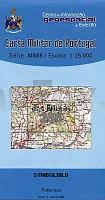
 | 236 - Topographische Landkarte Portugal 1:25.000 Carta Militar de Portugal - Série M888 Instituto Geográfico do Exército (IGeoE) - Portugal |
 | 2041 02 Koisjärvi Topographische Karte 1:20.000 (Maastokartta / Peruskartta / Grundkarta) Maanmittauslaitos / Lantmäteriverket Finnland - ProjektNord |
 | 430 Oeiras Topographische Landkarte Wanderkarte und Fahrradkarte Portugal 1:25.000 430 Mapa topográfico - Mapa de caminhadas - Portugal 1:25.000 ProjektNord |
 | 526-3 SERRADILLA DEL ARROYO Amtliche topographische Landkarte 1:25.000 Spanien (M.T.N.) 526-3 Mapa Topográfico Nacional de Espana (MTN25) Instituto Geográfico Nacional - CNIG Spanien |
 | 5725 Stangenroth Topographische Landkarte Bayern 1:25.000 - Normalausgabe - ProjektNord (geplottete Ausgabe) - Grundlage amtliche Topographische Karte Bayern DTK25 |
 | 3644 09+4622 06 Kuoskuvaara Topographische Karte 1:20.000 (Maastokartta / Peruskartta / Grundkarta) Maanmittauslaitos / Lantmäteriverket Finnland - ProjektNord |
 | Skjerstadfjorden - Rognan - Seekarte Norwegische Küste 1:50.000 - (Blatt 137) Den Norske Kyst Sjøkart - Hovedkart (sjø) Statens Kartverk Sjø - Norwegen |
 | 83 Vila Nova de Famalicao Topographische Landkarte Wanderkarte und Fahrradkarte Portugal 1:25.000 083 Mapa topográfico - Mapa de caminhadas - Portugal 1:25.000 ProjektNord |
 | 793-2 NAVALÃN Amtliche topographische Landkarte 1:25.000 Spanien (M.T.N.) 793-2 Mapa Topográfico Nacional de Espana (MTN25) Instituto Geográfico Nacional - CNIG Spanien |
 | 403 - Topographische Landkarte Portugal 1:25.000 Carta Militar de Portugal - Série M888 Instituto Geográfico do Exército (IGeoE) - Portugal |
 | Zalaer Hügelland Nördlicher Teil - Göcsej - Vasi-hegyhát Touristische Radwanderkarte - Wanderkarte 1:50.000 Szarvas - Ungarn Zalai-dombság (északi rész), Göcsej és Vasi-hegyhát turistatérkép |
 | 658-1 VILLAMUELAS Amtliche topographische Landkarte 1:25.000 Spanien (M.T.N.) 658-1 Mapa Topográfico Nacional de Espana (MTN25) Instituto Geográfico Nacional - CNIG Spanien |
 | 4112 08+11 Salo-Peltola Topographische Karte 1:20.000 (Maastokartta / Peruskartta / Grundkarta) Maanmittauslaitos / Lantmäteriverket Finnland - ProjektNord |
 | 4711 09 Koukkutunturi Topographische Karte 1:20.000 (Maastokartta / Peruskartta / Grundkarta) Maanmittauslaitos / Lantmäteriverket Finnland - ProjektNord |
 | 1042-II Bérchules Amtliche topographische Landkarte 1:25.000 Spanien (M.T.N.) 1042-II Mapa Topográfico Nacional de Espana (MTN25) Instituto Geográfico Nacional - CNIG Spanien |
 | 1033 06 Hem-Kråkskär Topographische Karte 1:20.000 (Maastokartta / Peruskartta / Grundkarta) Maanmittauslaitos / Lantmäteriverket Finnland - ProjektNord |
 | 351-1 POZALMURO Amtliche topographische Landkarte 1:25.000 Spanien (M.T.N.) 351-1 Mapa Topográfico Nacional de Espana (MTN25) Instituto Geográfico Nacional - CNIG Spanien |
 | 70 Höxter Südteil - Beverungen - Borgentreich - Peckelsheim - Warburg Wanderkarte NRW Topographische Wanderkarte 1:25.000 Nordrhein-Westfalen - Eggegebirgsverein |
 | 3332 10 Hannonmäki Topographische Karte 1:20.000 (Maastokartta / Peruskartta / Grundkarta) Maanmittauslaitos / Lantmäteriverket Finnland - ProjektNord |
 | 2731 06 Porttivuoma Topographische Karte 1:20.000 (Maastokartta / Peruskartta / Grundkarta) Maanmittauslaitos / Lantmäteriverket Finnland - ProjektNord |