| << Portugal: Amtliche topografische Landkarten des Instituto Geográfico do Exército (IGeoE) 1:25.000 (Serie M888) |
||
|
||

Zuletzt angesehene Artikel:
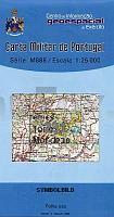
 | 231 - Topographische Landkarte Portugal 1:25.000 Carta Militar de Portugal - Série M888 Instituto Geográfico do Exército (IGeoE) - Portugal |
 | 4112 (NL 33-05-12) Bad Radkersburg Topographische Wanderkarte 1:50.000 mit Wegmarkierungen - Ãsterreich - Kartographie BEV - ProjektNord |
 | N6211 Kenraalinkylä Topographische Karte 1:25.000 EUREF (Peruskartta) Maanmittauslaitos / Lantmäteriverket Finnland - ProjektNord |
 | Kajakabenteuer entlang der Küste Norwegens Anleitungsbuch (schwedischsprachig) Kajakäventyr längs norska kusten Vildmarksbiblioteket Schweden |
 | Reichenbach (Eulengebirge) Kreiskarte des Deutschen Reiches 1:100.000 (KDR 100 KK) - Faksimile Reichsamt für Landesaufnahme |
 | Ãberleben in Extremsituationen Das Phänomen des Dritten Manns. Von John Geiger - Malik National Geographic |
 | N3144 Skaftung Topographische Karte 1:25.000 EUREF (Peruskartta) Maanmittauslaitos / Lantmäteriverket Finnland - ProjektNord |
 | Suwalszczyzna Touristische Wanderkarte/Radwanderkarte Polen 1:75.000 (GPS) Compass - Polen |
 | 2852 Schwedt / Oder - Gatow Sonderausgabe mit Wanderwegen - Topographische Wanderkarte Brandenburg 1:25.000 ProjektNord |
 | 3438 Jerichow Topographische Karte 1:25.000 Landesvermessungsamt Brandenburg (gefaltet) |
 | 4223 (NL 33-02-23) Weiz Topographische Wanderkarte 1:50.000 mit Wegmarkierungen - Ãsterreich - Kartographie BEV - ProjektNord |
 | 4304 (NM 33-11-04) Waidhofen an der Thaya Topographische Wanderkarte 1:50.000 mit Wegmarkierungen - Ãsterreich - Kartographie BEV - ProjektNord |
 | 5639 Adorf (151) - Geologische Karte 1:25.000 (GK25) Grundlage Messtischblatttopographie Sächsisches Landesamt für Umwelt, Landwirtschaft und Geologie |
 | 10118 Artfjellet Topographische Landkarte 1:50.000 Norge-serien - Nordeca Norwegen |
 | 5826 Bad Kissingen Süd Topographische Landkarte Bayern 1:25.000 - Normalausgabe - ProjektNord (geplottete Ausgabe) - Grundlage amtliche Topographische Karte Bayern DTK25 |
 | 105O12 Fango Lake - Yukon Territory Topographische Landkarte 1:50.000 - Canada - Yukon |
 | 100 Greatest Cycling Climbs of the Tour de France Radwanderführer Frankreich - Vertebrate Publishing |
 | 294 Topographische Landkarte Wanderkarte und Fahrradkarte Portugal 1:25.000 294 Mapa topográfico - Mapa de caminhadas - Portugal 1:25.000 ProjektNord |
 | 2216-II Hobro - mit Wanderwegen und Fahrradrouten Topographische Fahrradkarte und Wanderkarte Dänemark 1:50.000 - Kort & Matrikelstyrelsen ProjektNord 2216-II Hobro - Topografisk Cykel- og Vandrekort Danmark |
 | Karadsch - Touristischer Stadtplan-Atlas Zentrum und Gemeinde (Nr. 392) StraÃenatlas Englisch und Persisch اطلس گردشگري شهر و شهرستان كرج - Tourist Atlas of Karaj City & Township Gitashenasi - Iran |